
Author: Lukasz


OSTROWY TUSZOWSKIE, GM. CMOLAS, POW. KOLBUSZOWSKI
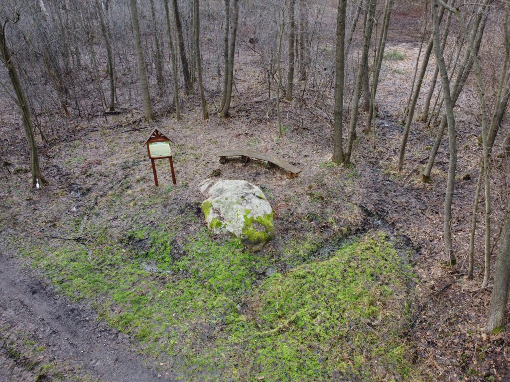
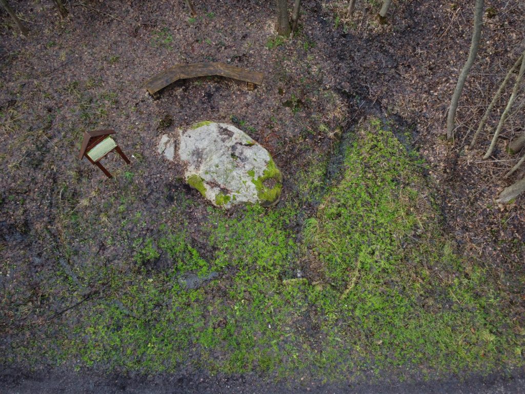
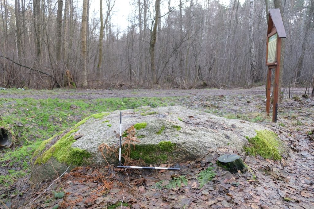
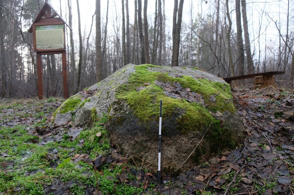
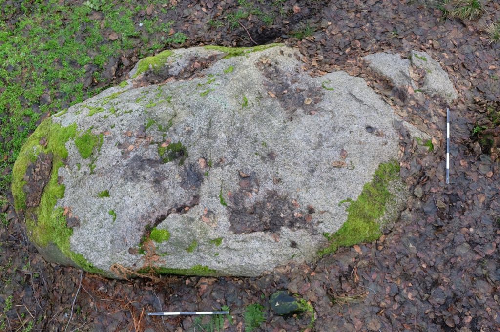
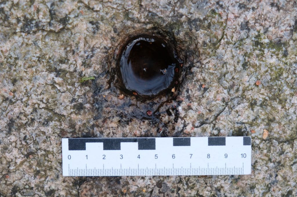
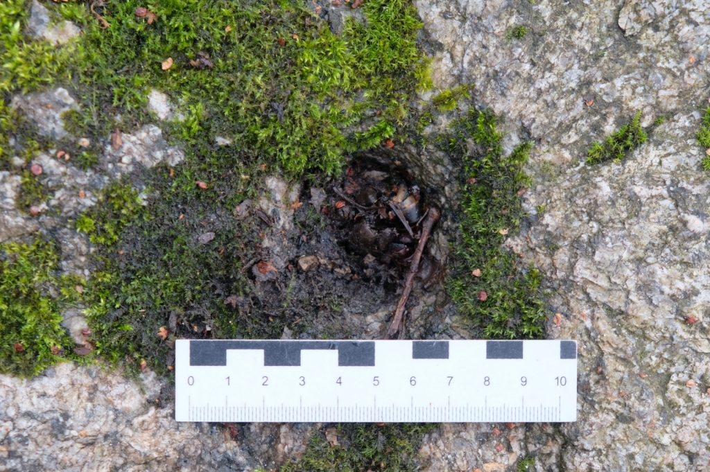
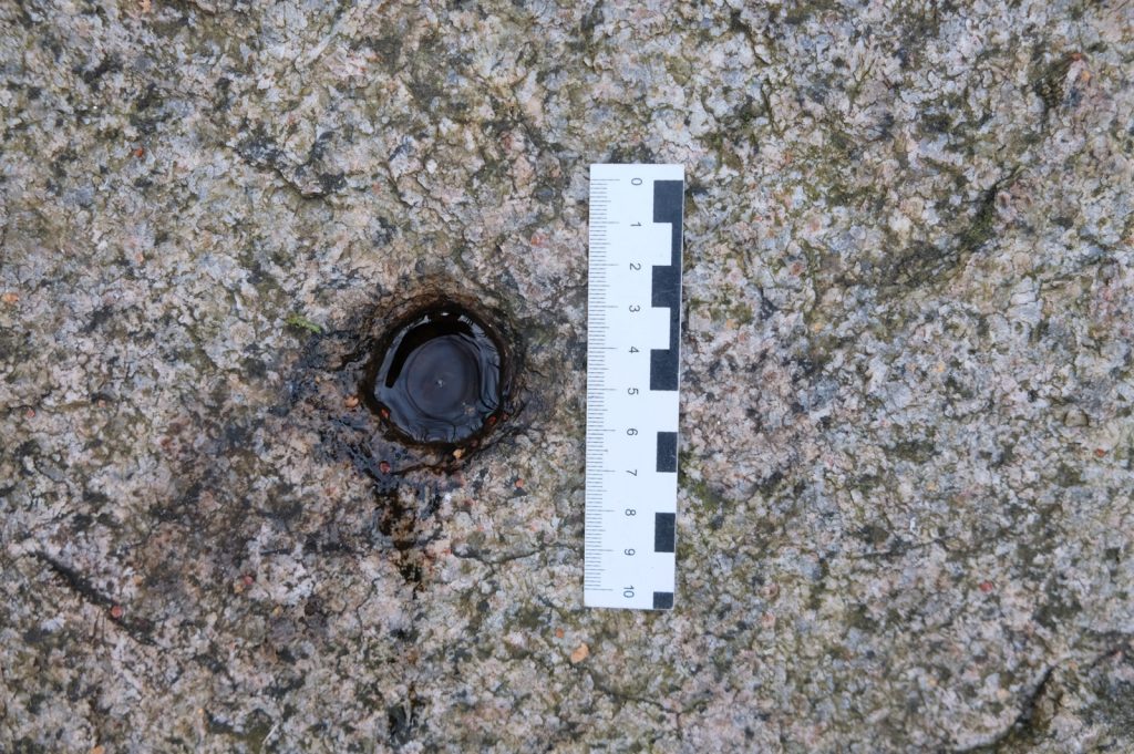
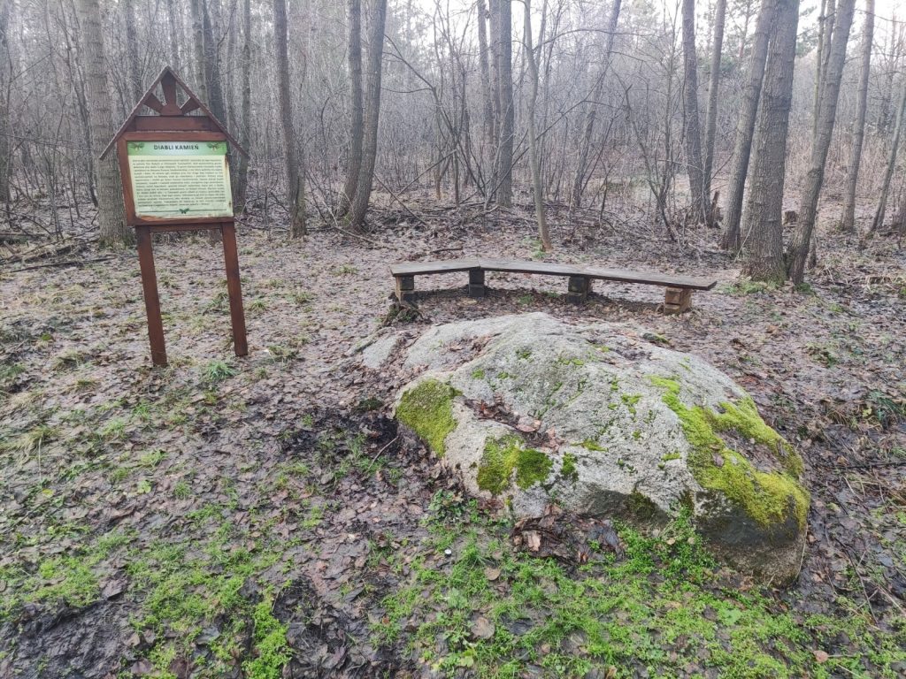
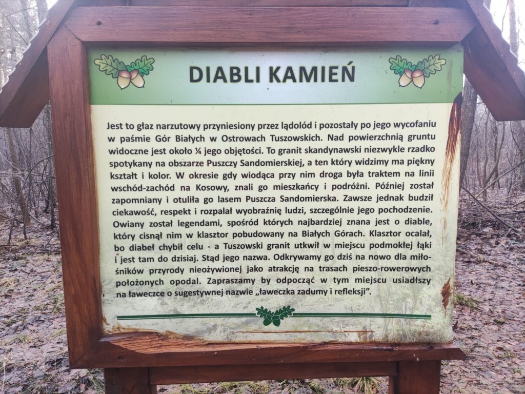
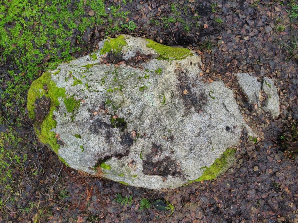
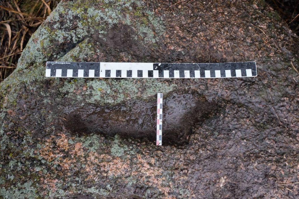
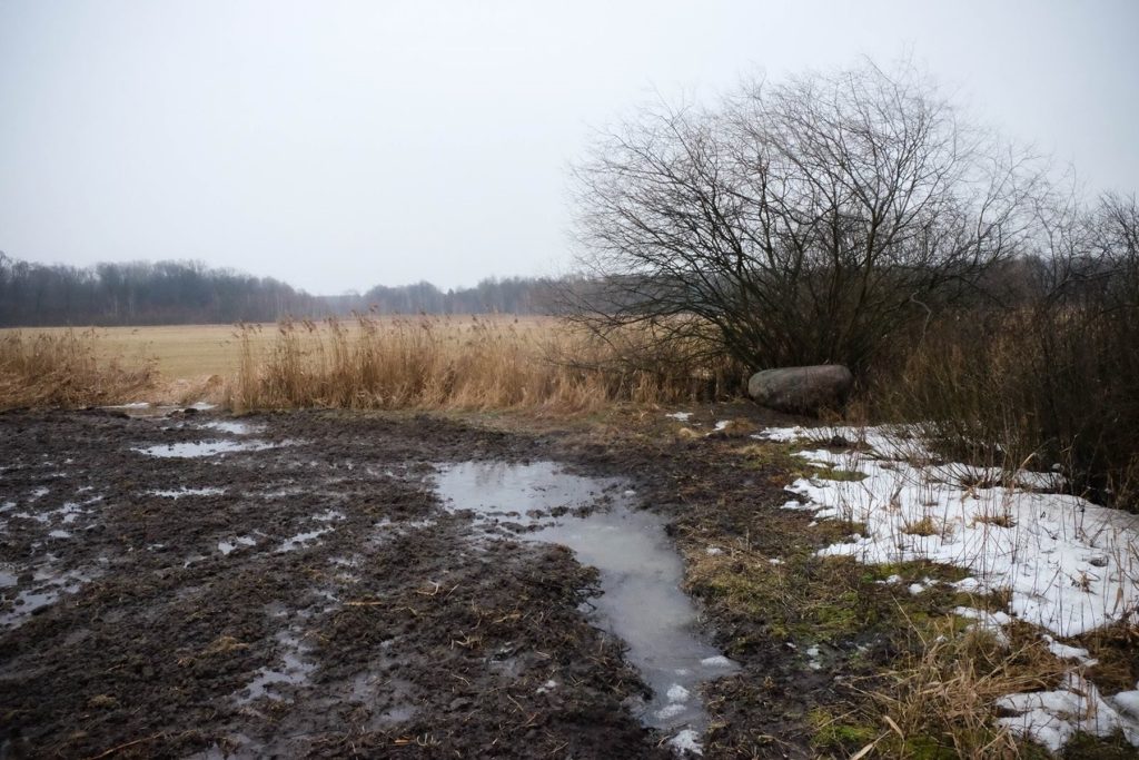
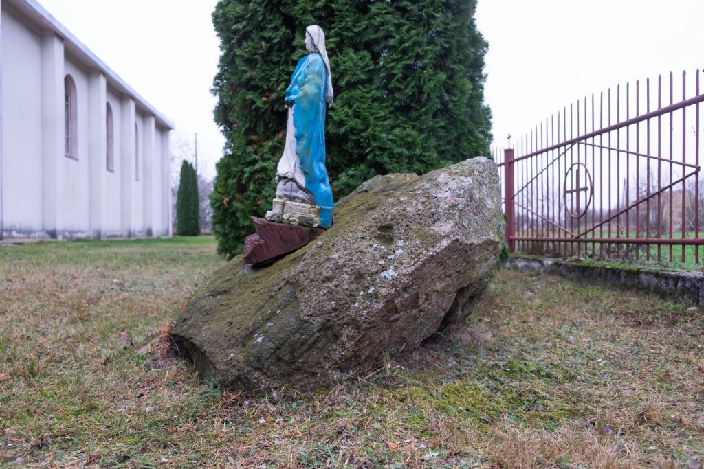
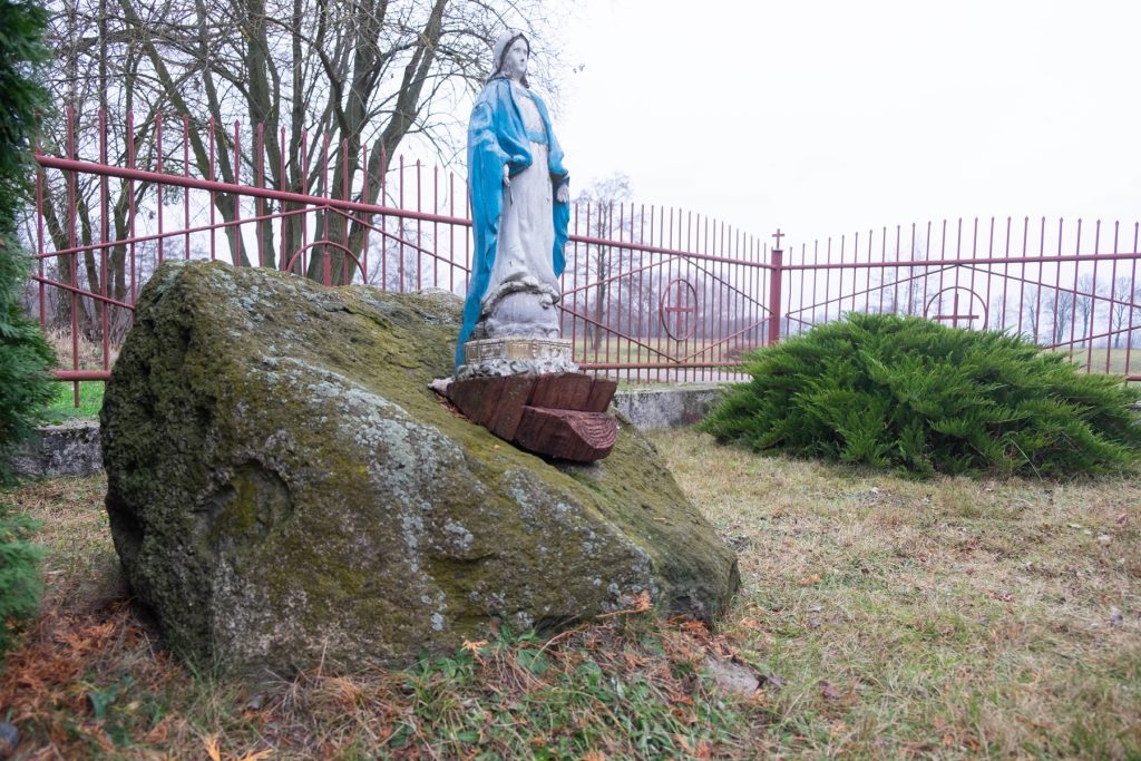
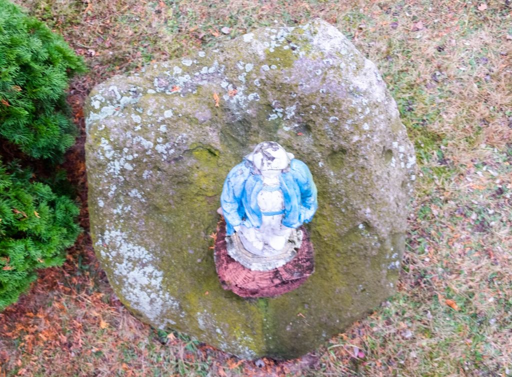
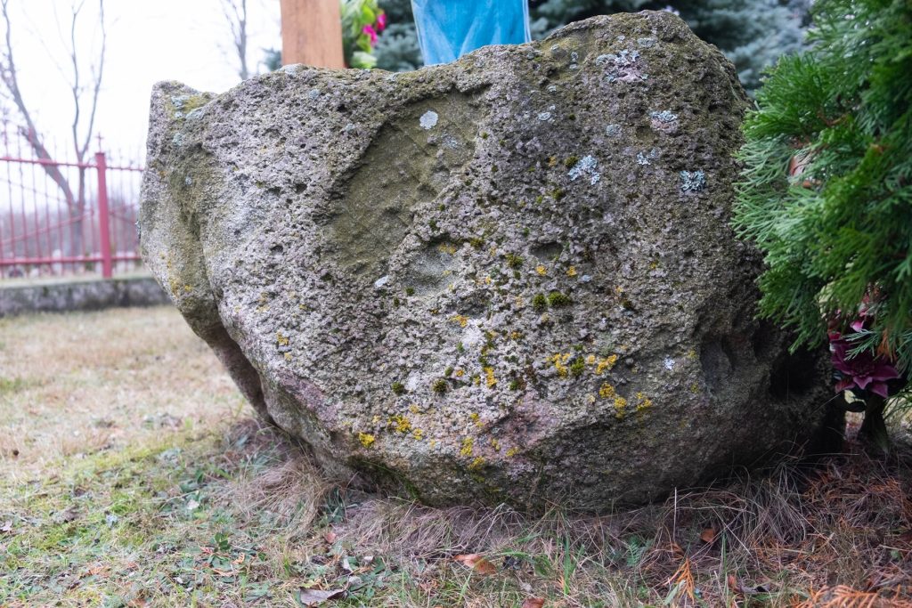
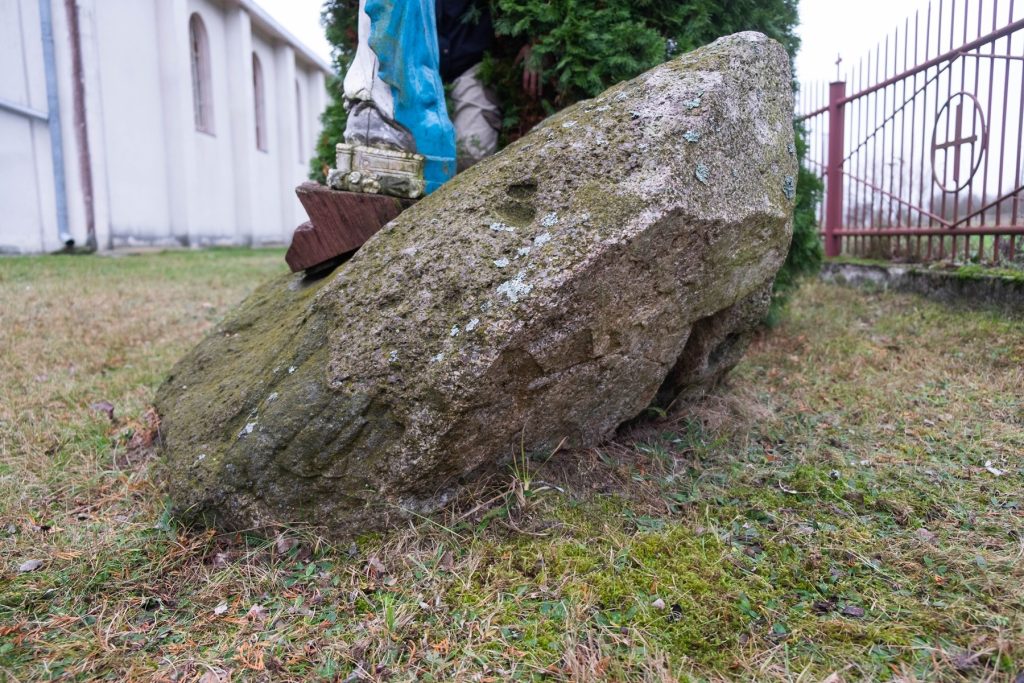
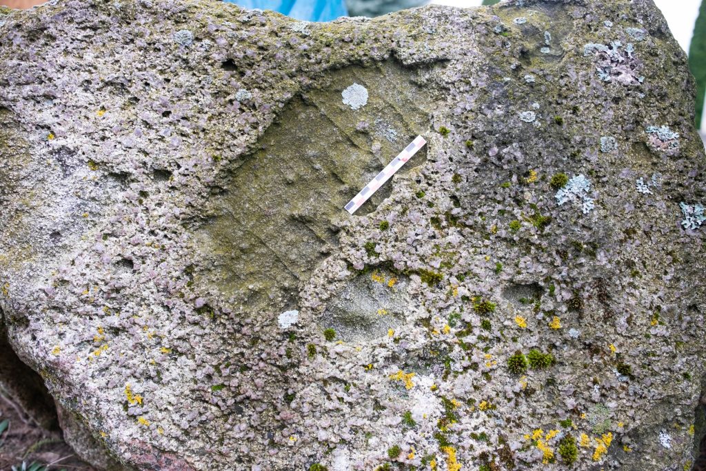
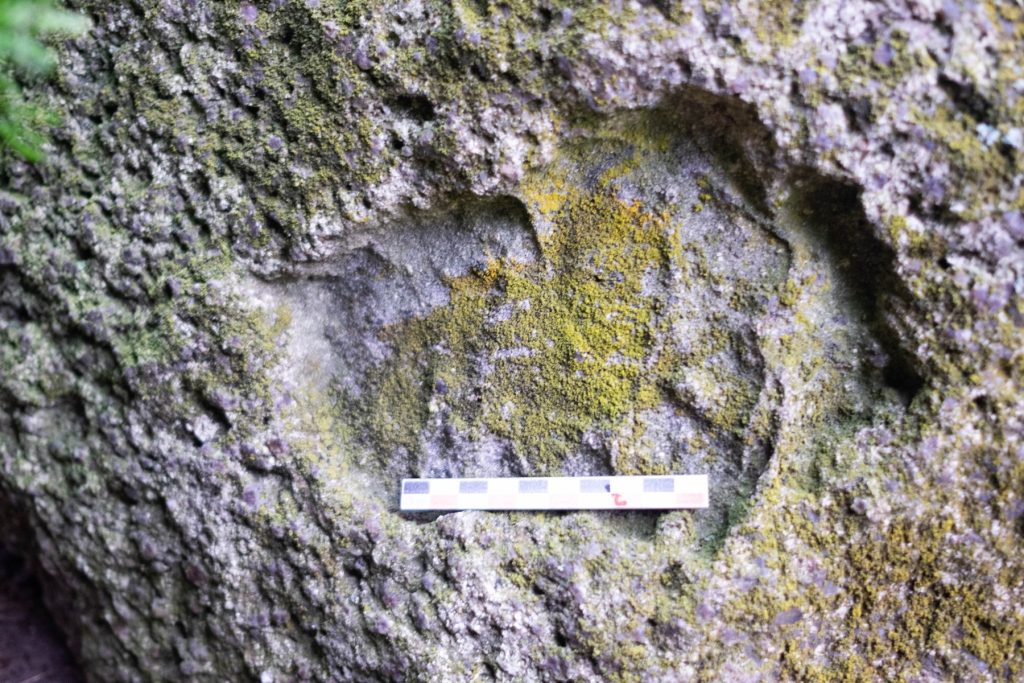
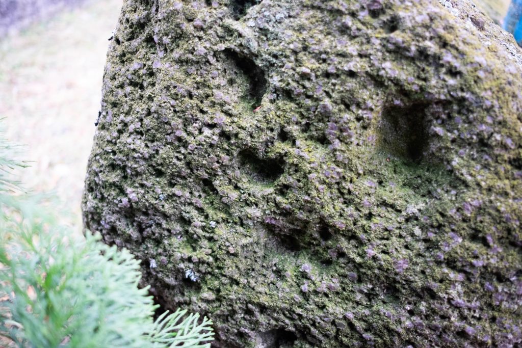
An erratic boulder (Scandinavian granite) with dimensions: length 3 m, width 2.2 m, height 0.8 m. On the surface one can see holes created by drilling with an auger, probably in order to split the stone or during the celebration of the so-called "Sobotka".
According to local beliefs, the devil appeared on the stone in various forms. One version of the legend says that the devil was supposed to hurl a stone at the monastery in the White Mountains, however, he missed, and the stone was hurled into the marshy meadows. A spring bursts out just nearby, but no information has been recorded regarding possible beliefs about it. The boulder is located in a marshy wetland at the foot of the so-called "Monastery Hill." Currently it is a forested area of the Sandomierz Forest, but a few decades ago it was occupied by meadows. According to local tradition, there was supposed to be a monastery (or church) here, which had collapsed, or possibly a "pagan charm". On Pentecost, local residents used to burn St. John's Day fires at the site.
Geographic coordinates: 50.301492, 21.655571
Sources of information: Kotula 1974, 174-175, Fig. 87; information board; field queries
Location of place on Heldensfeld's map of Western Galicia (1801-1804); (Anton Mayer von Heldensfeld, Carte von West-Gallizien welche [...] in den Jahren von 1801 bis 1804...}.

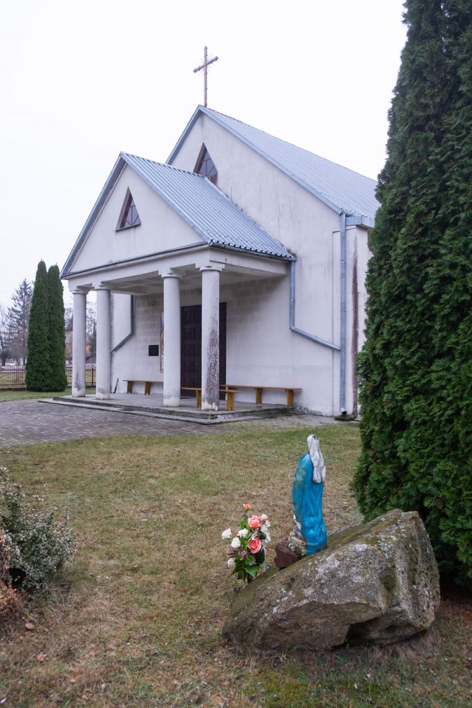
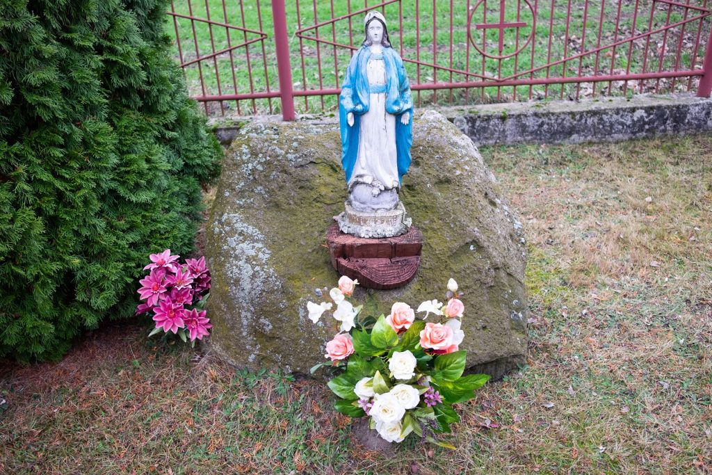
MASONRY EAGLE, COMMUNE. IZBICA, POW. KRASNOSTAWSKI
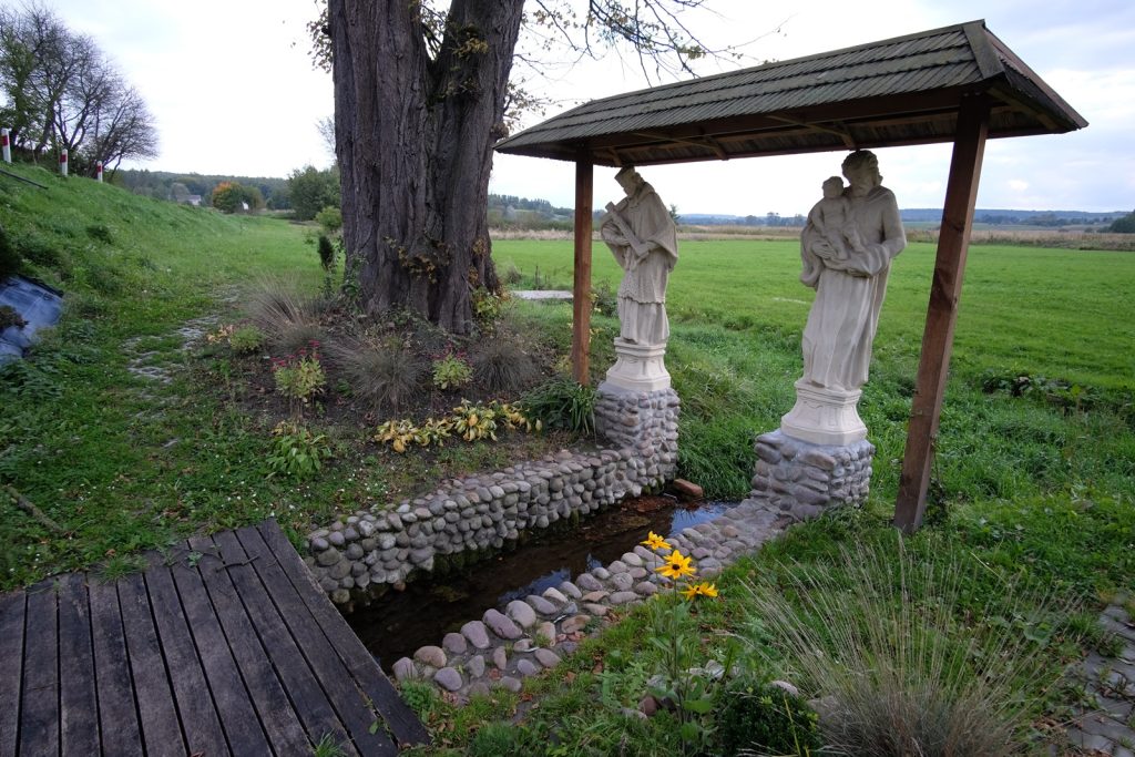
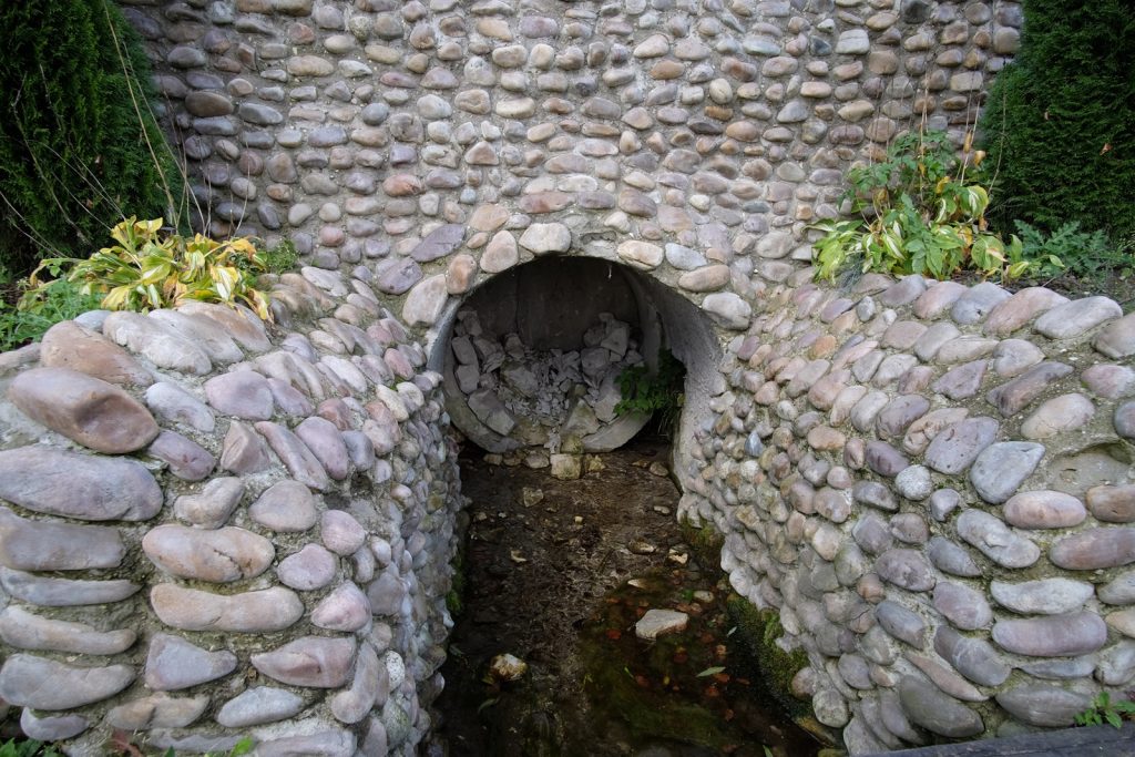
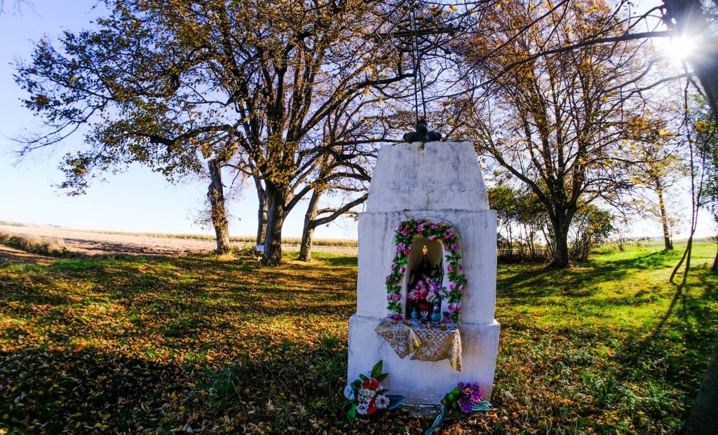
The spring with the "miraculous water" of St. John Nepomuzen located by the road, encased in stones. The first mention of St. John's spring dates back to 1878, it is found in the will of Kajetan Klicki, owner of the Orlovsk estate.
Every Holy Saturday, sick people would flock here to wash their sick spots in the miraculous water. By the local population the spring is surrounded by veneration. Two statues - St. John Nepomucen and St. Anthony Paderewski - and an information board have been placed next to it.
Sources of information: interview among residents of the village of Orlovy Murowany; information board at the source.
Geographic coordinates: 50.89546, 23.23648
Location on Heldensfeld's map Western Galicia (1801-1804)


JABŁONNA DRUGA, GM. JABŁONNA, POW. LUBELSKI
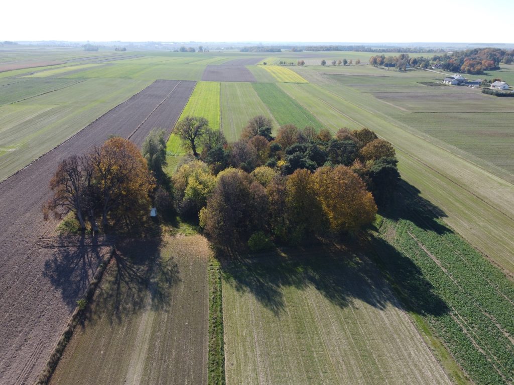
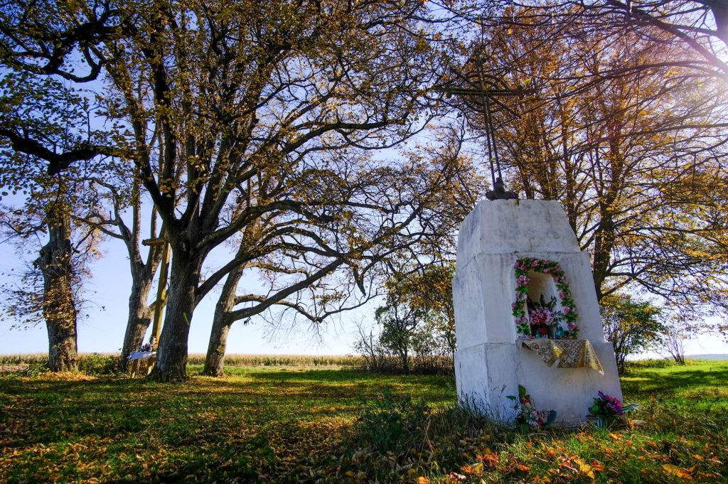
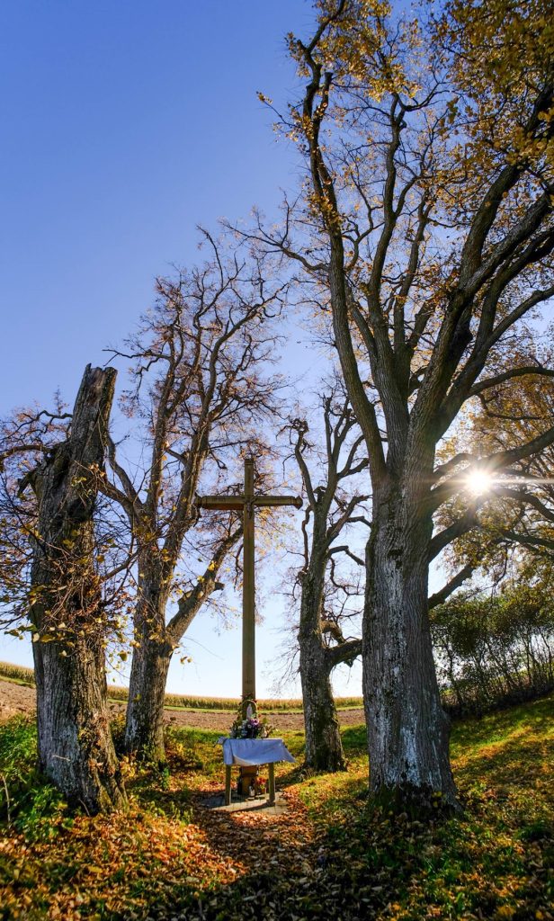
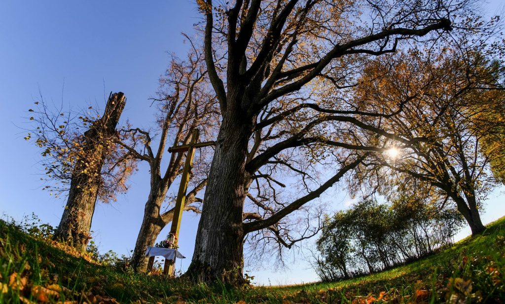
A former place of worship with the local name "Bushes", "God's mercy". It is located on the culmination of a small hill, above the valley of the Czerniejówka stream, on the grounds of the village of Jablonna Druga. In a small grove is located a wooden cross and a brick chapel. As late as in the 2nd decade of the 21st century, a sizable stone lay near the wooden cross. According to local tradition, its surface bore the imprinted footprints of the Lord Jesus, who ascended to heaven from this place or rested while wandering the world. In 2019, the stone was stolen. According to the Geographical Dictionary of the Kingdom of Poland, "God's Mercy" was "considered by the people to be a miraculous place, where for a long time on the Ascension of the Lord companies of several miles gather, pray under the cross and with earth, as if miraculous, wounds and sick parts of the body poultice. For a long time, the owners of Jablonna sought permission from the spiritual authority to erect a chapel "in the bushes," which was not allowed" (Słownik
Geograficzny...I, 489). In turn, according to W. Koźmian's description of 1903, for several hundred years it was supposed to have been a place of pilgrimage for the local population on Ascension Day, however, without the participation of the clergy and landowners who were hostile to the cult. The belief in the healing power of the clay deposited at the site, especially helpful for rheumatism and other incurable diseases, was widespread and strong. On Ascension Day, those suffering from various ailments who came here in large numbers were expected to bury and poultice their ailing body parts with the earth.
An analysis of Antoni Mayer von Heldensfeld's map of 1802-1804 indicates that "God's Mercy" was originally located in the area of a larger forest complex, covering the entire elevation.
In the 19th century, the owners of the Jablonna estate ordered the clearing of the forest and the grove, which met with opposition from the residents of the surrounding villages. At the beginning of the twentieth century, two wooden crosses were to stand in the place next to the stone. Religious practices were accompanied by fairs, during which, according to W. Koźmian, devotional items were traded, among other things (Koźmian 1903, 511).
In the chronicle of the Bychawka parish there is a record stating that on May 17, 1928 a procession of over a thousand believers, organized by the local priest Borlewicz, set out from Bychawka to the miraculous place "in Krzaczki". From 1930 comes the description of a direct participant of the events: "The sight of lying, earth-covered children and the elderly, and their families, feeding these sick and praying over them, takes us involuntarily to some darkness of medieval medical practices.
The departing people break lime branches for the road, which they brew at home for rheumatism patients. All around, numerous market stalls and hustle and bustle as if at a fair. Despite the presence of a priest and the day of a Catholic holiday, the whole thing gives the impression of a pagan charm" (after Januszek 2015, 21). After World War II, the cult of the place enjoyed less and less popularity. In 2020. "Bushes" was entered in the register of historical monuments as a historical place of religious worship and placed under conservation protection.
Sources of information: Geographical Dictionary 1880-1904, I, 489; Koźmian 1903, 510-511; Januszek 2015, 21;
Krzaczki, Record Card of the Monument in the Archives of the Voivodship Office in Lublin dated 15.05.2020; field queries
Geographic coordinates: 51.069018, 22.600826
Forest with a wonder spot on Heldensfeld's map of Western Galicia (1801-1804)

EMILCIN, GM. OPOLE LUBELSKIE, POW. OPOLSKI
The boulder is located in a clearing in the forest, between the villages of Emilcin and Komaszyce, Opole Lubelskie municipality. According to local legend, there was supposed to be an imprint of the Blessed Virgin Mary's foot on its surface. The boulder was lost in the 1980s. It was taken to Warsaw by employees of the School of Head Farming, then sunk in a pond in Obory near Konstancin. It was thought to be related to the widely reported third-degree encounter with a UFO by village resident Jan Wolski.
Information sources: https://www.dziennikwschodni.pl/magazyn/tajemnicadiabelskiego-kamieniawideo,n,1000071844.html (accessed April 20, 2023); field search
The original location of the stone on Google maps
Archival photos of the Emilcin stone along with the footer available here.

SHANIAWY-PONIATY, GM. TRZEBIESZÓW, POV. LUKOWSKI
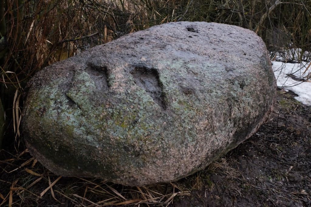
Granite with longitudinal forcings, located in the fields near the village. Dimensions of the boulder 120 × 80 × 70 cm. The carvings are very clear, their length reaches 30 cm while their width is 10 cm. According to one of the villagers, these were supposed to be footprints of Jesus wandering around the world. A few years ago the stone was removed from the field and laid on its edge, near a drainage ditch.
Sources of information: field search
Geographic coordinates: 51.950955, 22.555671


Stone after removal from the field


Original location of the stone in the field, photo by R. Solecki, 2017.(Original location in the field, before removal)

KRZYWOWÓLKA, GM. SŁAWATYCZE, POV. BIALSKI
The granite boulder, measuring 1.8 × 1.5 × 1 m, with numerous natural depressions on its surface, is currently set next to the Church of Our Lady of Sowing in Krzywowólka. Our Lady of Sowing in Krzywowólka. It was originally located in the Muszaryniec (Mucharyniec) wilderness in the forest between the villages of Krzywowólka, Matiaszówka and Sajnówka. Later it was moved under the church by the residents of the village of Krzywowólka.
According to local tradition, the Mother of God appeared on a stone located in the charm, leaving footprints in the rock. A local legend also speaks of a rosary "imprinted" in the stone.
The Musharin resort itself is shrouded in legends. It is a round-shaped island located in a marshy area that is difficult to access. Today overgrown with dwarf trees, it is most likely a remnant of a peat bog. According to a local legend, in the unspecified past there was supposed to be a temple (church, orthodox church) here, which, along with the faithful, sank into the swamp. The place is said to be haunted by evil forces.
Sources of information: field search

MALESZE, GM. WYSZKI, POW. BIELSKI
According to information by Fyodor V. Pokrovsky in 1895 (p. 124), there was a stone with the imprint of the left human foot in the territory of the parish of Malesze, in the "Bozhaya Stopka" beauty spot. According to tradition, it was left by the Mother of God, who passed through there. The stone could not be found in the field.
Sources of information: Pokrovskij 1895, 124
DOLISTOWO STARE, GM. JAŚWIŁY, POW. MONIECKI
In 1884, on a stone located in a meadow near the village - the so-called "Bocianek". - to three residents of the village of Dolistowo: Franciszka Łuszcz, Salomea Chodorowska and Maria Krysztopa, the figure of the Virgin Mary appeared to them. The tangible proof was to be the footprints visible on the surface of the boulder. According to local tradition, "imprints" of two feet were visible in the stone, one very clear and deep, with a length of 8 cm, the other trace was shallower. The event was given the name of the miracle "on Bocianek". A wooden cross was placed next to the boulder. In 1947, from the contributions of the villagers, a chapel was founded in which the "miracle stone" was used as an altar. In 1984, a well was built at the "miracle site", the water from which is said to have miraculous properties.
Information sources: "Chapel Stories" entry on https://e-grajewo.pl/wiadomosci,11358,rss.html (accessed September 15, 2022)
Geographic coordinates: 53.53479, 22.90506

CZARNOCIN, GM. RADZANÓW, POW. WHITOBRZESKI
Near the village of Czarnocin, on the road to the village of Wólka, there is a small boulder. It shows an indentation resembling the trace of an animal's paw. Associated with it is a legend about a huge lizard that once ravaged the area. According to it, one day a mysterious woman came to the village of Czarnocin, leaned over the stone and put something on it. She ordered the villagers not to step on the stone from now on. At nightfall, the lizard came out of the forest and dashed toward the people waiting by the stone. As soon as it stepped on it, it immediately began to shrink in size and size until it disappeared completely. Only the trace of the monster's paw remained in the stone. A smaller depression is supposed to be the imprint of the paw of a dog that stood on the boulder and also disappeared.
Dimensions of the stone: 70 × 50 × 30 cm. Natural indentations are visible on the surface.
Sources of information: Gierala 2013; field queries
Geographic coordinates: 51.52975, 20.80767


