Stone with horseshoe and cross - destroyed. According to W. Pracki, on the border of the villages of Olszewnica and Zarzyce (Zarzec) there was supposed to be a large stone with an engraved horseshoe and a cross with a "double figure" and an additional engraved letter "Z". A field search revealed that the stone had been destroyed. According to the mayor of Olszewnica, the stone was smashed after World War II and used for road construction. It was possible to trace its exact location, by the road, on the border of Olszewnica village and Kolonia Zarzec. The stone served as a boundary marker. During the field search, no information on beliefs or legends related to the stone was recorded among the residents of Olszewnica and Zarzec villages. A photograph of the monument in situ was included in W. Pracki (p. 121, fig. 53).
Sources of information: Pracki 1900, 121 (fig. 53); field queries
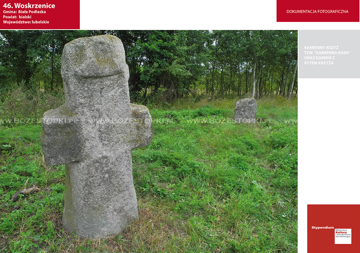
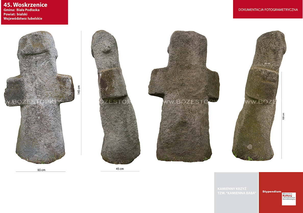
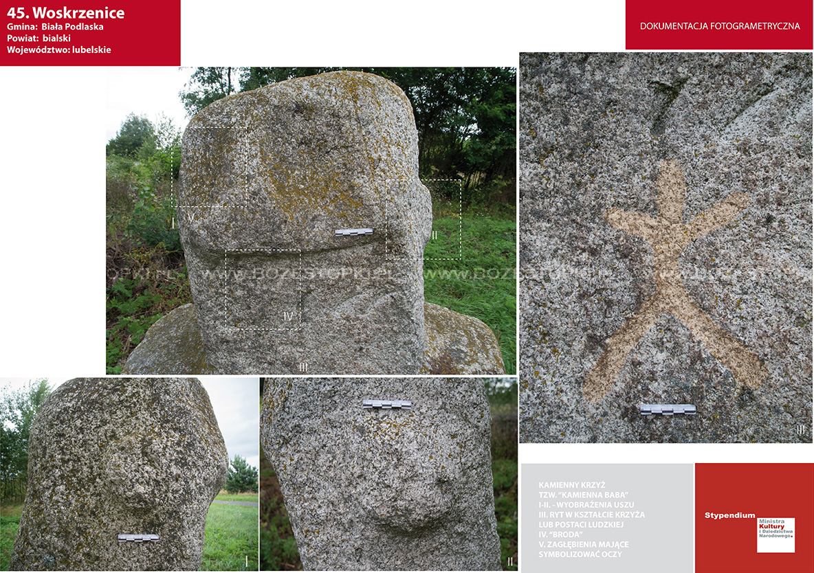
A stone cross made of gray granite, standing at the intersection of roads in Woskrzenice Duży.
The top of the cross is molded in the shape of a human head, with only the auricles clearly distinguished; Due to its anthropomorphic shape, the cross is commonly referred to as a "stone baba." It was once meant to stand in a field outside the village, as was a second stone with an engraved cross set next to it.
The cross is an example of late medieval or modern stone folk sculpture.
The second monument is a stone of gray granite with an engraved cross, standing near the cross at the intersection of roads in Woskrzenice Duży. It is likely to be a modern grave stone.
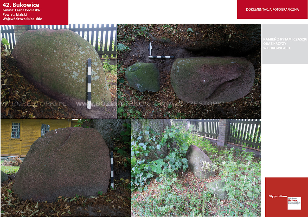
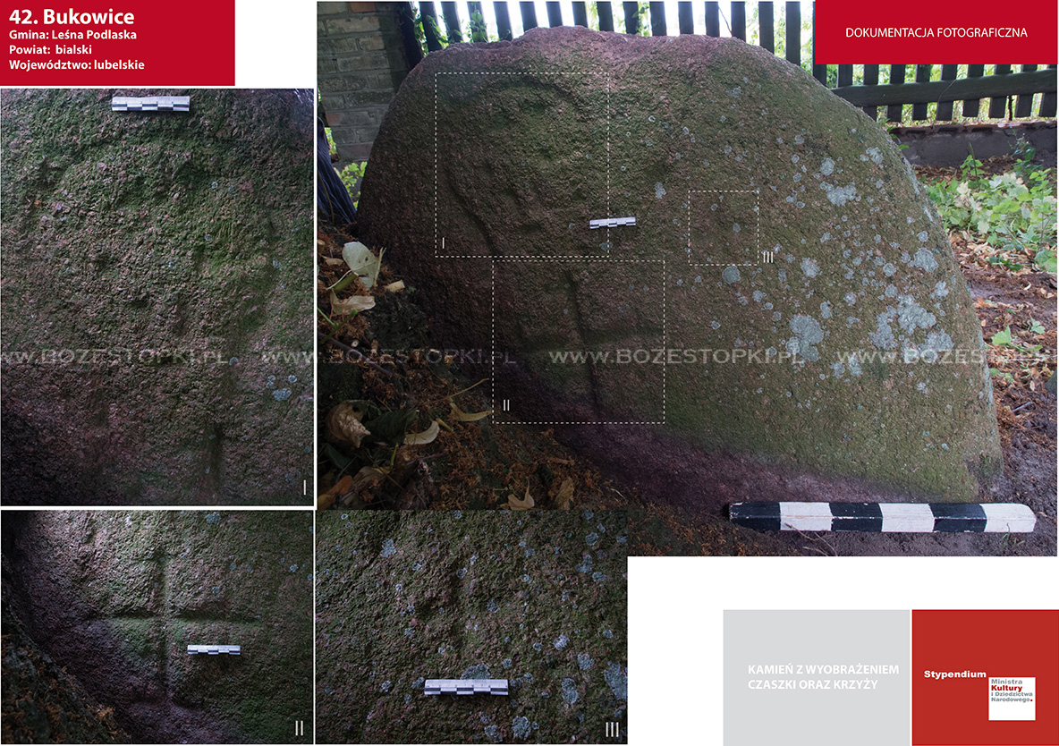
Stone (gray granite) with an engraving of a human skull and two crosses. The stone lies by the church in Bukowice, on the right side of the temple.
According to a record of an 18th-century church visitation, the temple was surrounded by a fence made of loose stones not bonded together with mortar. The stone with engravings is one of three that survived - no anthropogenic traces were noted on the other two.
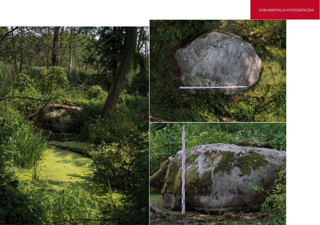
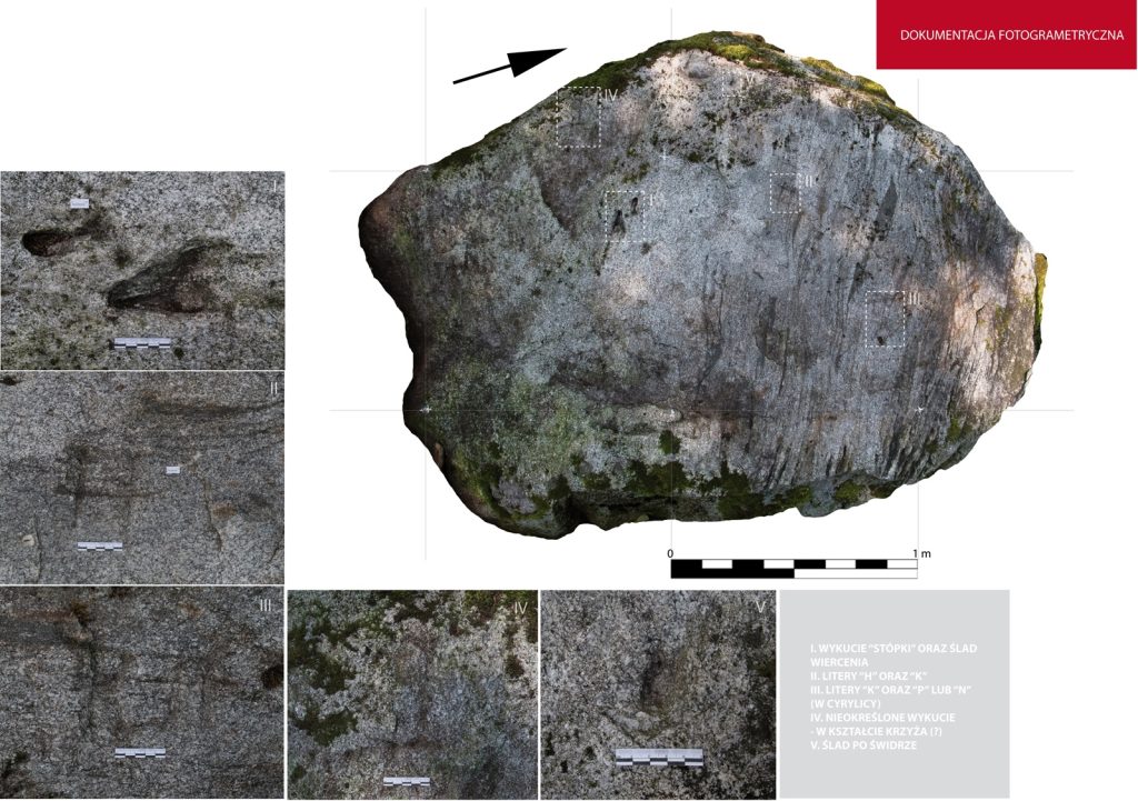
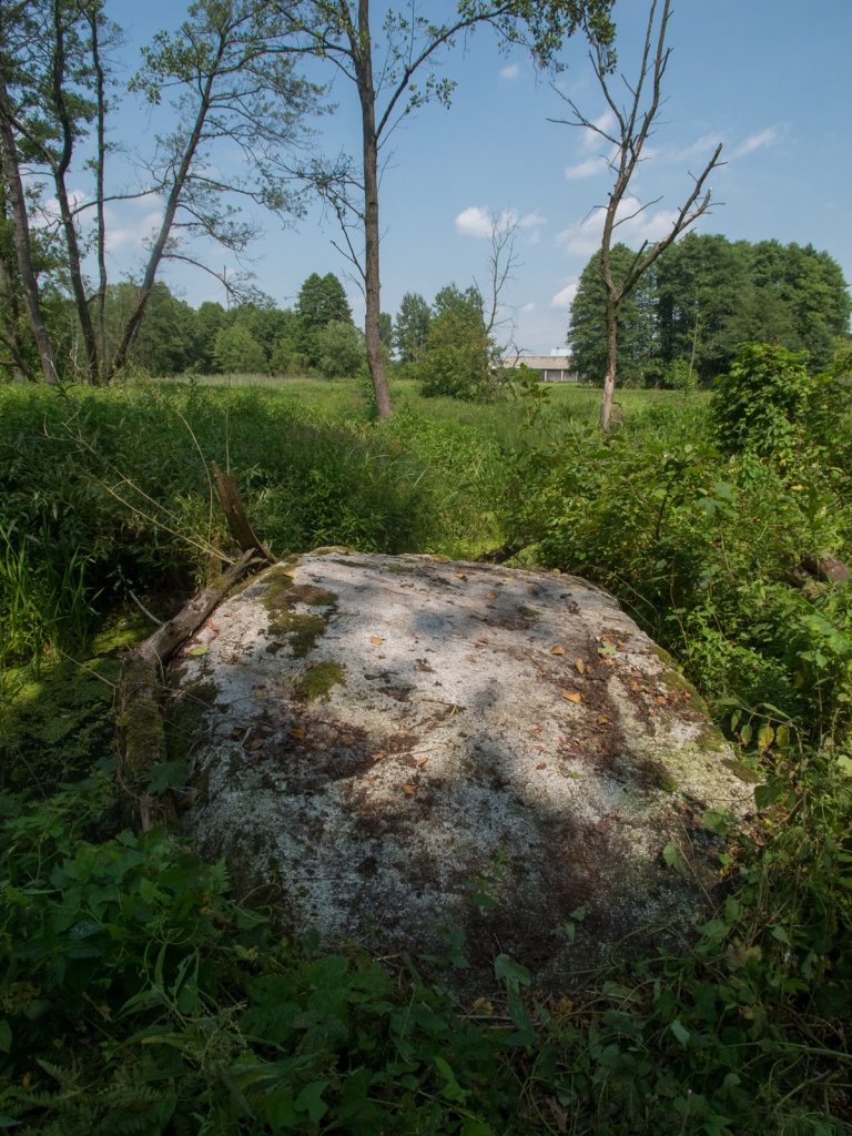
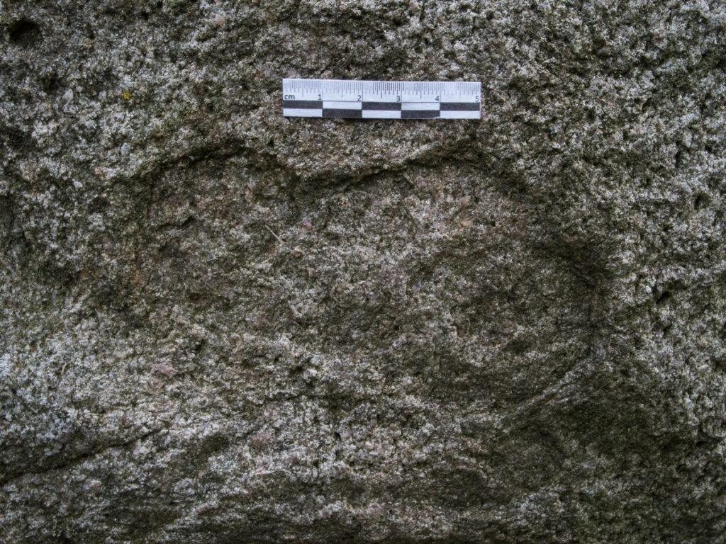
Granite erratic boulder measuring 250 × 170 × 90 cm, partially submerged in the Szysi River, located west of the Klukowo village buildings. The surface shows traces of forging of the "foot". The size of the forging is 10 × 6 cm, 2 cm deep. An isolated big toe is visible, next to it there is a symmetrical depression of 3 cm in diameter, probably after an auger. In addition, an indistinct cross with two arms (?), the letters "K" and "N" or "K" and "L", possibly "P" in Cyrillic; "H" and "K" written in Cyrillic.
According to one informant, the foot is a trace of the Lord Jesus resting on the stone, while the symmetrical hole is a trace of his staff.
According to the description of B. Werner (1917), there was a huge stone called "Yost", on the upper surface of which bowl-shaped, elliptical depressions were visible, which, according to tradition, were traces of "the elbows, knees and beard of the Lord Jesus." In addition, the stone was said to have a cross and letters engraved on it. The stone had the proper name "Yost". According to locals, there were also footprints on the boulder.
Around 1907, on the orders of the local parson, the stone was destroyed, and the material thus obtained was used to build the steps of the church under construction in Kolbiela. Information about the considerable size of the boulder is confirmed by the fact that about 100 carts of stone were transported to Kolbiela after it was blasted. According to the description of B. Werner, the upper part of the stone with signs, the local population did not want to give it back and it was placed in front of the St. Anne's shrine, which had already been built in this place after the stone was destroyed.
On Easter, the local people gathered around the boulder and deposited leftover sacred food and money in the hollows. On that day, food was also brought - "pieces of pie, sausages, dairy products" and deposited on the stone along with money. These offerings were later taken by beggars trailing behind the procession. The water accumulating in the hollows was said to have healing properties. This rite, like the stone, was called "Yost".
A detailed account of its course in the 1980s was posted by T. Chludzinski (1981). Every Easter Sunday, a procession would set out from Glupianka and surrounding villages to the site, headed by women with a choir leader, followed by men and youths of up to 500 people. Until the 1970s, the procession was held without a priest. The procession reached a brick chapel standing in a field, after which Marian chants and prayers were said for an hour. After the ceremony was completed, its participants would return to the village, where a dance party was held at the local firehouse. Only elderly women stayed in front of the shrine, "who celebrated the rosary together loudly for some time."
Since the traditional "Yost" rituals around the stone, and later the shrine erected in its place, were held without the participation of the clergy until the mid-1970s, it seems that their origin may be much earlier (cf. Miechowicz 2010, 50-52). Since the 1970s, the procession to the shrine has been strictly church-based. A typical Catholic field mass is held at the "Yost" site.
During the first field search in 2009, the visible part of the stone on the surface was documented. In 2013, on the initiative of local people, the boulder was excavated from the ground, while its fragments were placed and displayed next to the shrine. The pit left by the stone was lined with cobblestones. Currently, the shrine as well as the cross standing near it are renovated. The stone with cavities is exposed near the cross.
Sources of information: Werner 1917; Chludzinski 1981; Jot-Drużycki 2002; Herz 2012, 323-324; Miechowicz 2010, 50-52.
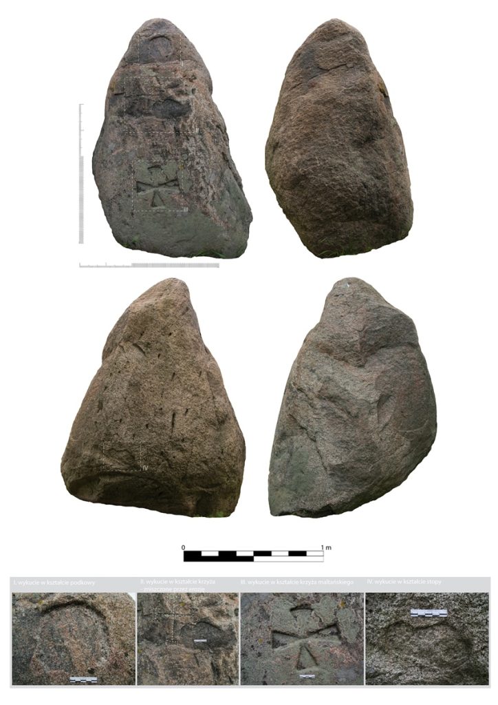
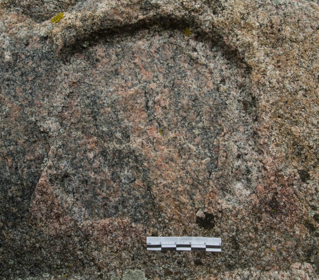
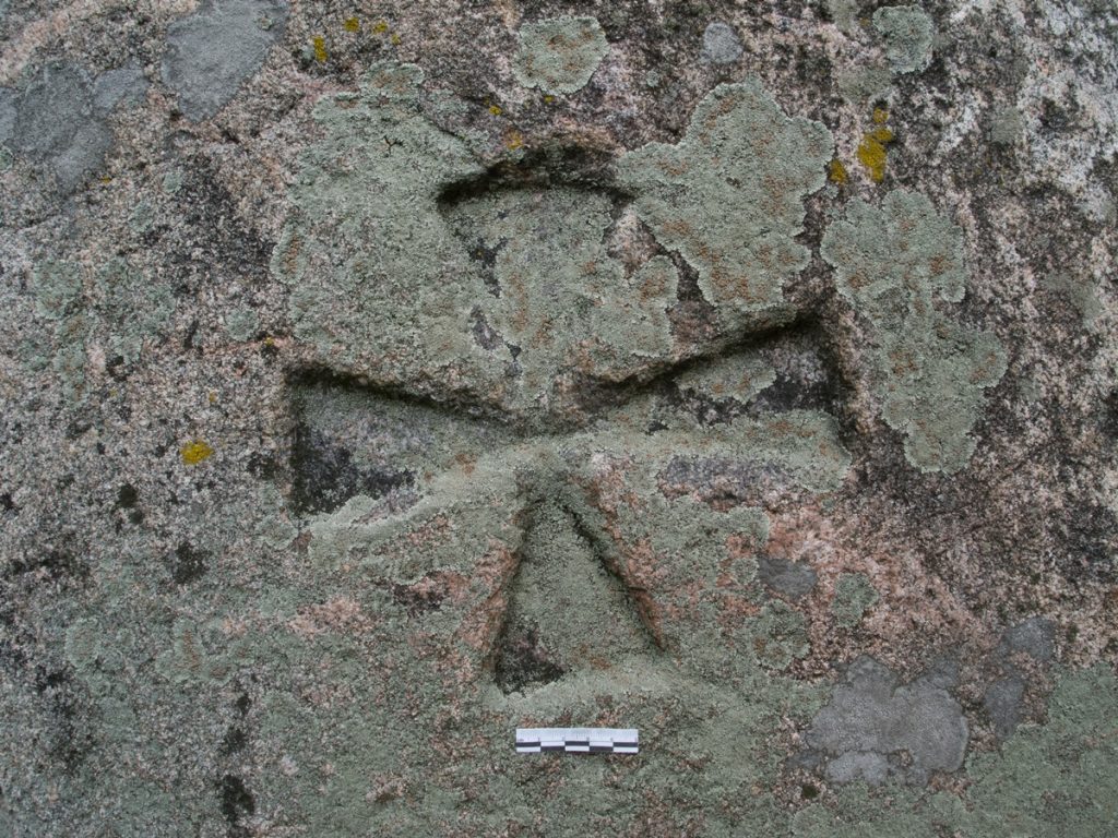
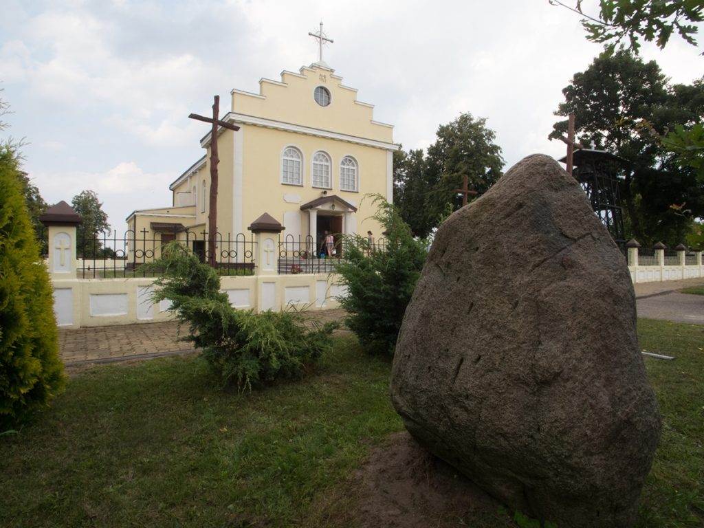
An erratic boulder, partially hewn. It originally served as a boundary stone on the border of the villages of Luzki and Czekanów. According to Kazimierz Stołyhwo, the stone has an anthropomorphic form and is a cult object, while Roman Jakimowicz favors its function as a boundary marker. The stone was originally located on the border of fields between the villages of Luzki and Niemirki. According to a local legend, the boulder stood on the grave of a witch, hence the stone's proper name "Witch". A horseshoe sign was carved in the upper part of the stone, an isosceles cross in the middle, and a Maltese cross in the lower part. On the opposite side of the stone, a footprint was carved in its lower part. In 2006, the stone was moved to Czekanow and placed in front of the local church.
Sources of information: Stołyhwo 1922; field queries
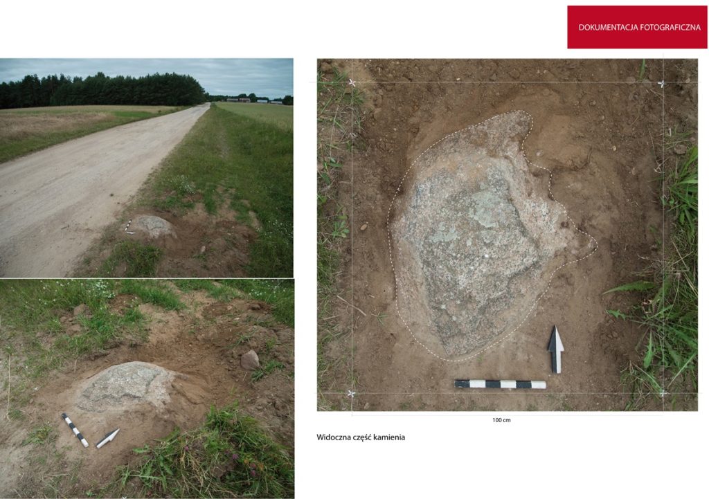
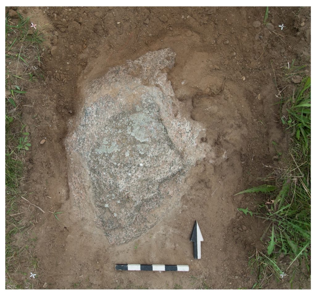
An erratic boulder made of gray granite. Local tradition links the marks on the stone to an apparition of the Virgin Mary. According to Wladyslaw Jarecki (1902), the stone was supposed to show a trace of the left foot with clear fingerprints and the sign of the cross with a base. According to local informants, various "marks and hollows" were present on the stone, as well as the "imprinted" trace of a human foot.
Originally, the boulder lay on the border of the villages of Wyszomierz and Kutyski. Currently, the stone is buried just off the road on a hill near the border of Wyszomierz village. This was done during road widening works. Only a small part of it, measuring about 40 × 40 cm, is visible on the surface. Initially, the stone was supposed to lie on the opposite side of the road than it does now. It was to be a large boulder of human height.
Sources of information: Jarecki 1902, 128; field queries
An erratic boulder of red granite, according to tradition with an imprint of the foot of the Virgin Mary or St. Jack. It is built into a chapel standing next to St. Jack's church. Legend links it to St. Jack Odrowaz, a Silesian-born Dominican who visited Mazovia in the first half of the 13th century during one of his missionary journeys. In the vicinity of Wyszogród, together with the missionary brothers accompanying him, he crossed the swollen Vistula River on his own cloak "as in the safest boat". According to local lore, the footprint left by the saint is a reminder of this crossing (according to the Geographical Dictionary of the Polish Kingdom and the monograph by M. Baruch, the foot of the Virgin Mary was supposed to be imprinted on the stone). The stone is partially enclosed by a brick chapel topped with a cast iron cross; originally the boulder was the base for a statue of the Virgin Mary. Dimensions of the stone: front 125 cm wide, 127 cm high; back part 137 cm wide, 140 cm high; width 80 cm (the part enclosed by the shrine). Footprint on the left side of the stone, dimensions 18 × 5 cm, depth 0.5 cm. In the lower part of the stone a forging in the form of a cross, in the upper part a niche. The name of the village is said to derive from the stone (Geographical Dictionary 1902, XV, 51).
Sources of information: Geographical Dictionary 1902, XV, 51; Baruch 1907, 28; field queries