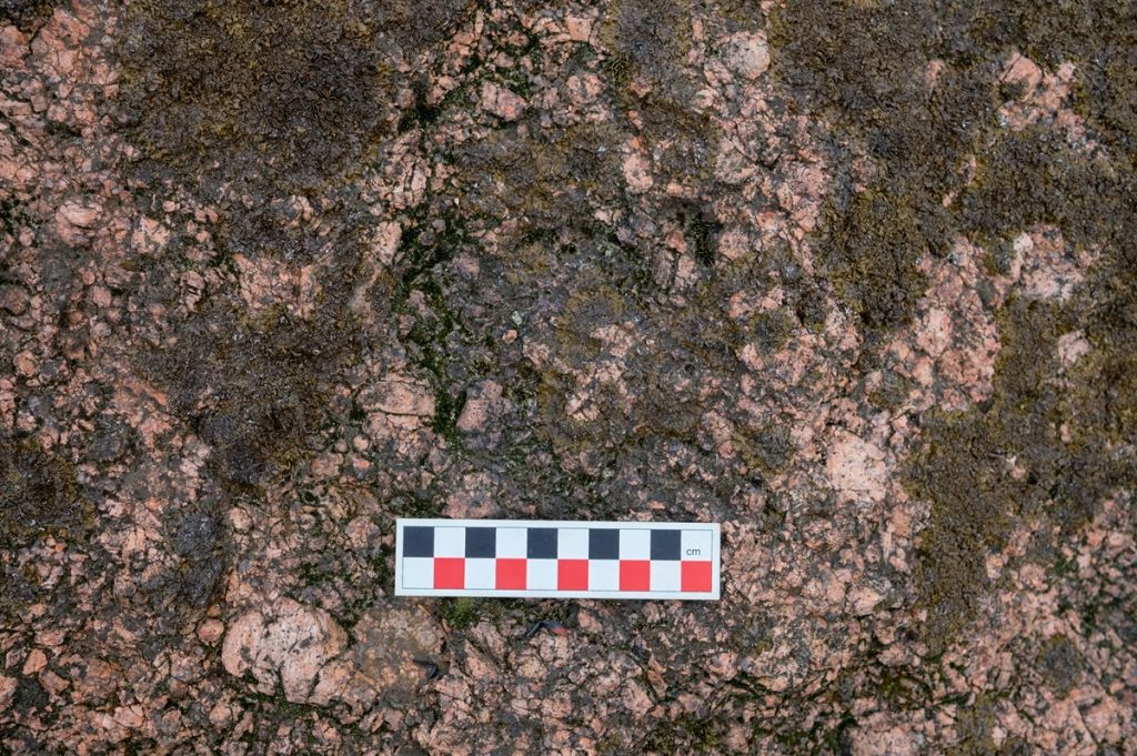
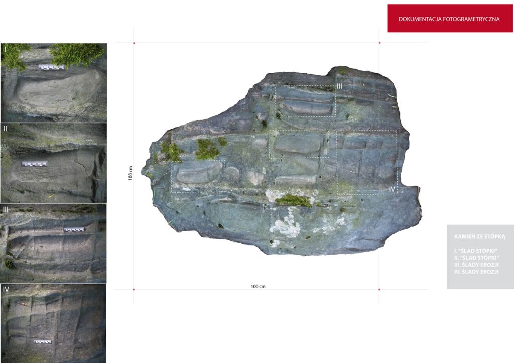
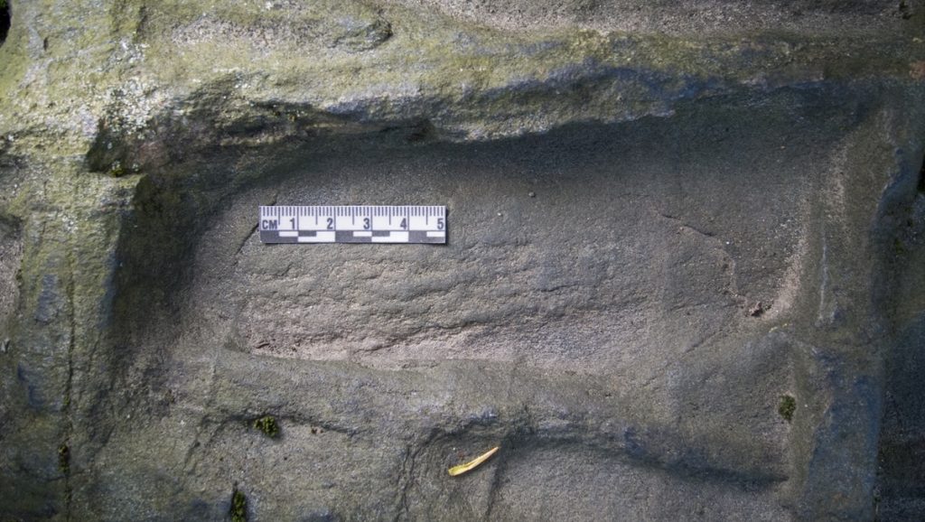
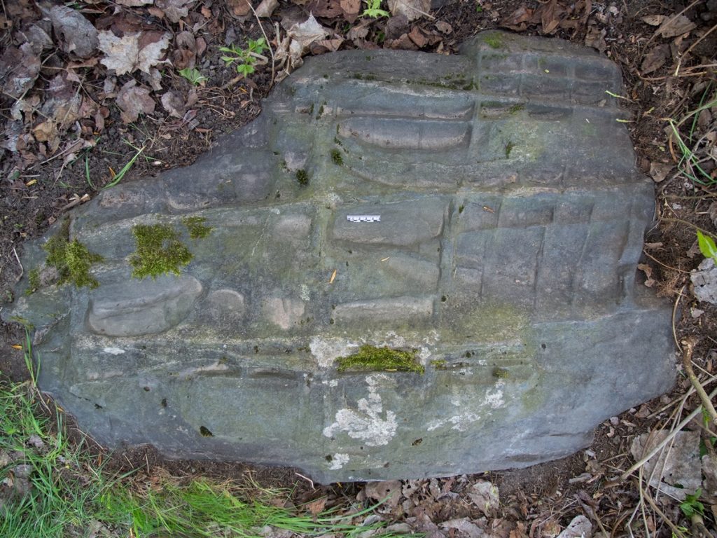
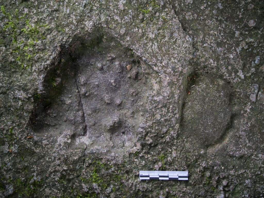
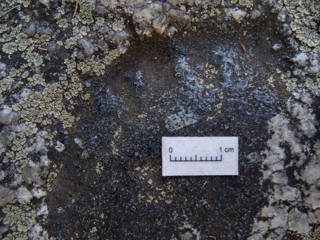
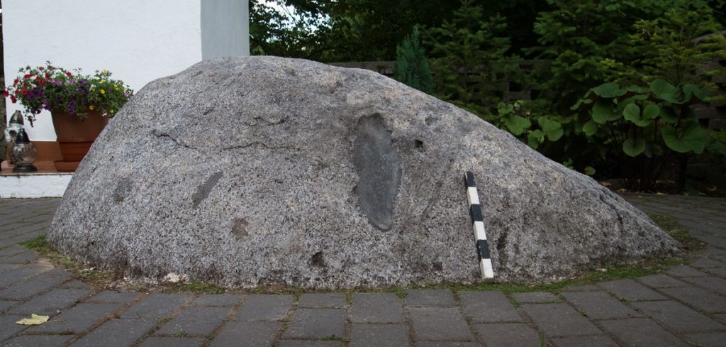
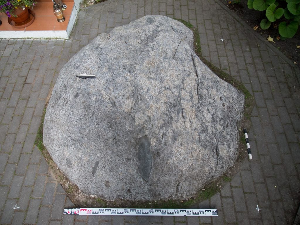
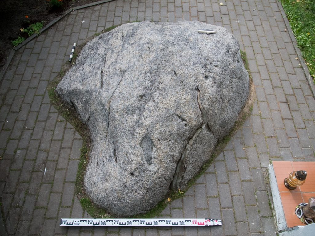
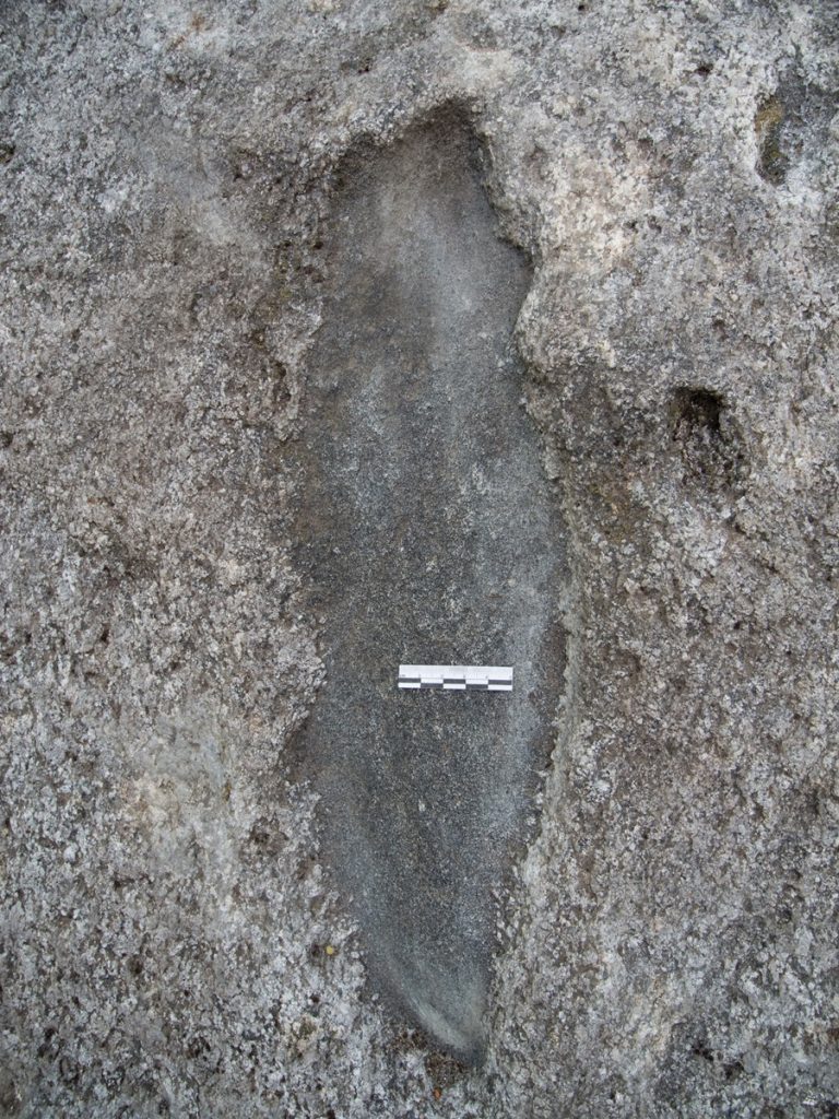
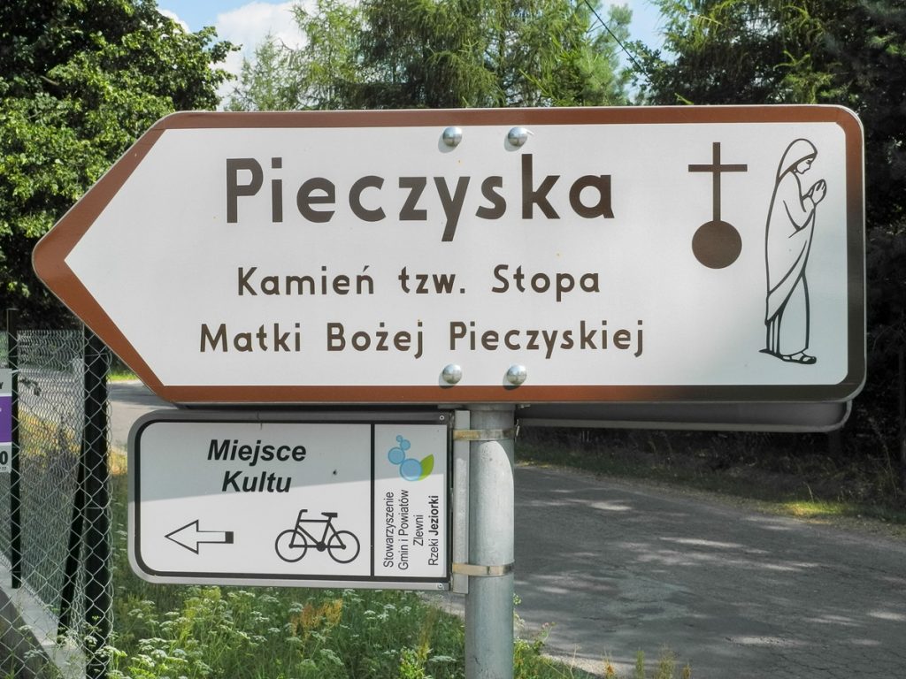
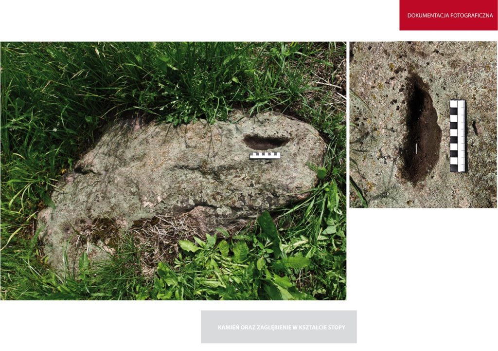
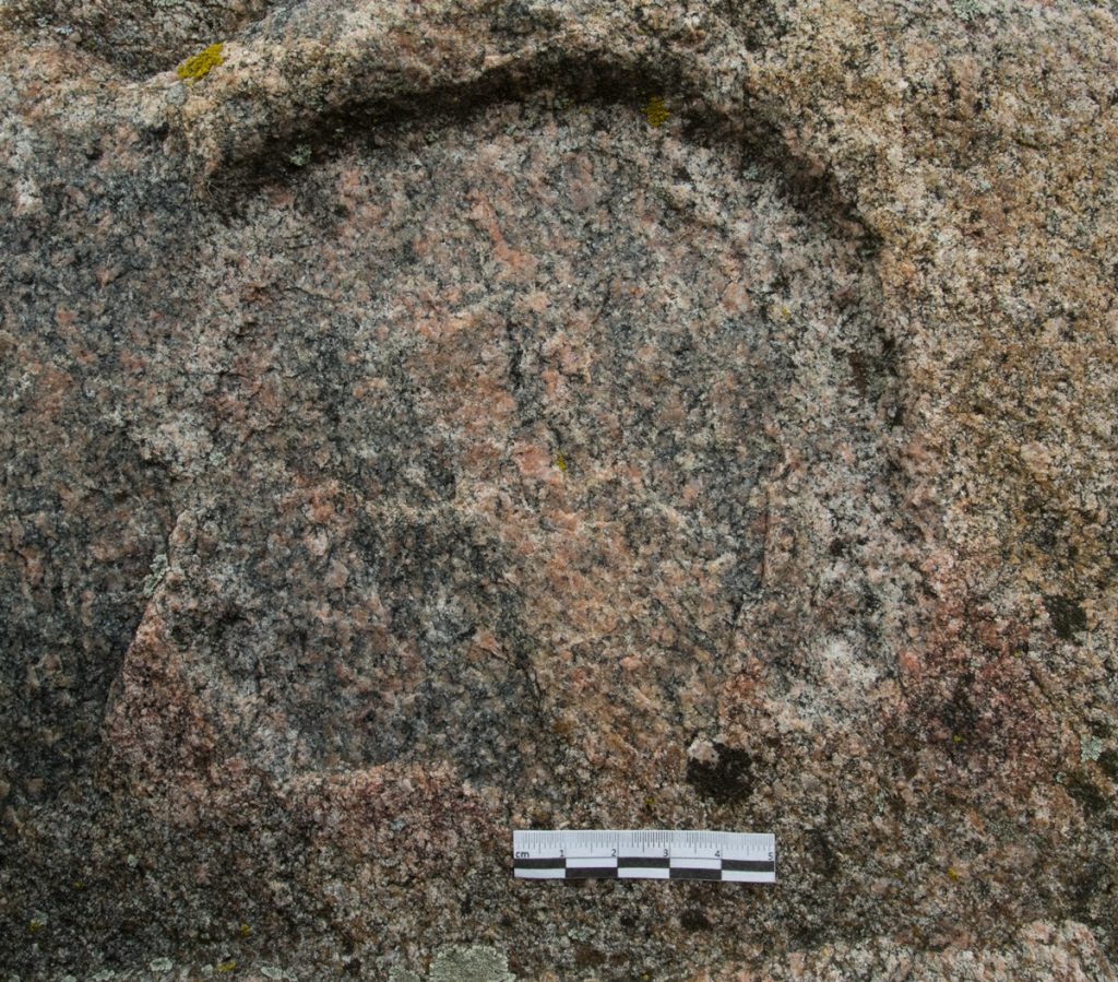
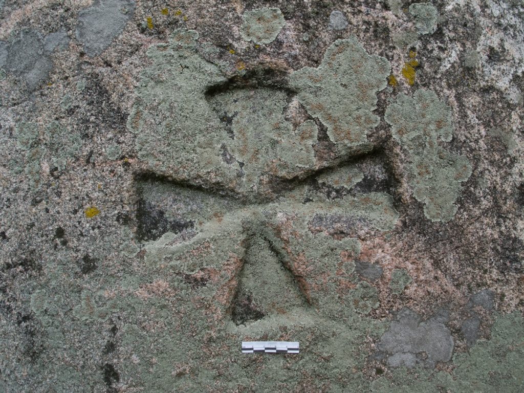
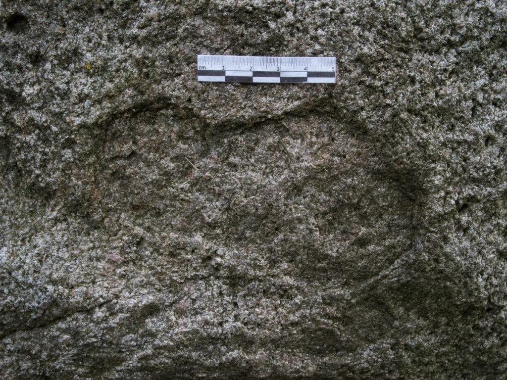
According to the description of B. Werner (1917), there was a huge stone called "Yost", on the upper surface of which bowl-shaped, elliptical depressions were visible, which, according to tradition, were traces of "the elbows, knees and beard of the Lord Jesus." In addition, the stone was said to have a cross and letters engraved on it. The stone had the proper name "Yost". According to locals, there were also footprints on the boulder.
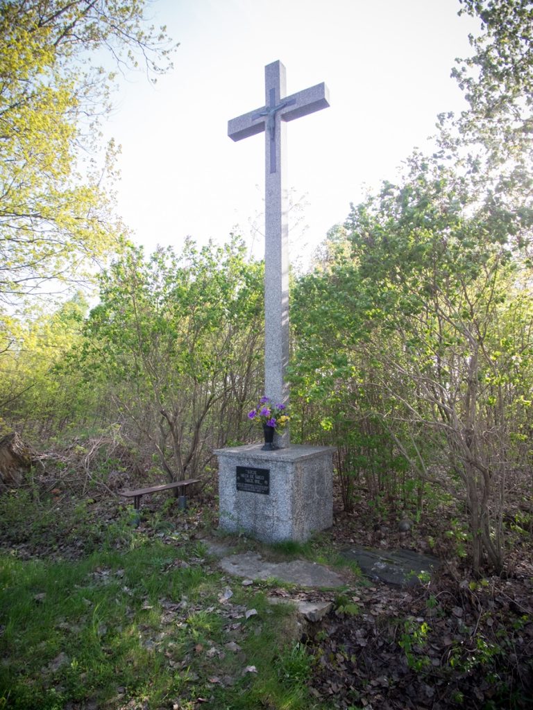
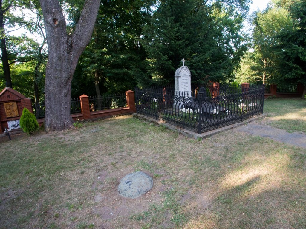
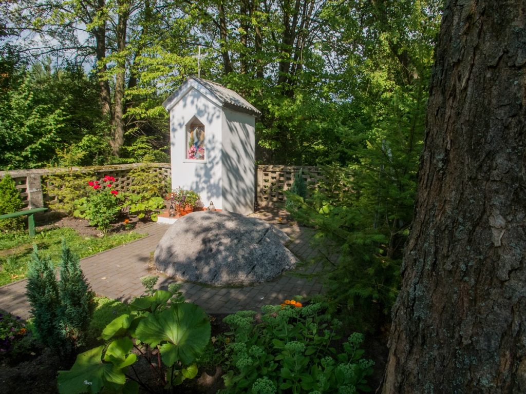
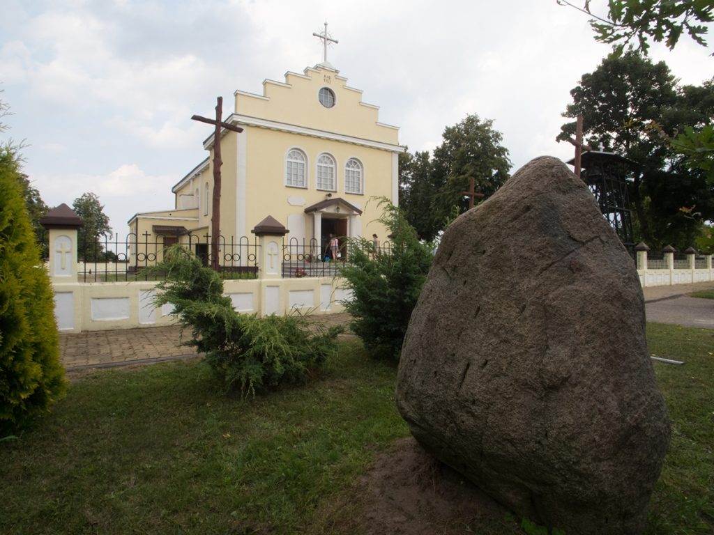
Around 1907, on the orders of the local parson, the stone was destroyed, and the material thus obtained was used to build the steps of the church under construction in Kolbiela. Information about the considerable size of the boulder is confirmed by the fact that about 100 carts of stone were transported to Kolbiela after it was blasted. According to the description of B. Werner, the upper part of the stone with signs, the local population did not want to give it back and it was placed in front of the St. Anne's shrine, which had already been built in this place after the stone was destroyed.
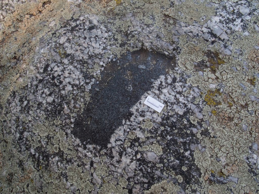
On Easter, the local people gathered around the boulder and deposited leftover sacred food and money in the hollows. On that day, food was also brought - "pieces of pie, sausages, dairy products" and deposited on the stone along with money. These offerings were later taken by beggars trailing behind the procession. The water accumulating in the hollows was said to have healing properties. This rite, like the stone, was called "Yost".
A detailed account of its course in the 1980s was posted by T. Chludzinski (1981). Every Easter Sunday, a procession would set out from Glupianka and surrounding villages to the site, headed by women with a choir leader, followed by men and youths of up to 500 people. Until the 1970s, the procession was held without a priest. The procession reached a brick chapel standing in a field, after which Marian chants and prayers were said for an hour. After the ceremony was completed, its participants would return to the village, where a dance party was held at the local firehouse. Only elderly women stayed in front of the shrine, "who celebrated the rosary together loudly for some time."
Since the traditional "Yost" rituals around the stone, and later the shrine erected in its place, were held without the participation of the clergy until the mid-1970s, it seems that their origin may be much earlier (cf. Miechowicz 2010, 50-52). Since the 1970s, the procession to the shrine has been strictly church-based. A typical Catholic field mass is held at the "Yost" site.
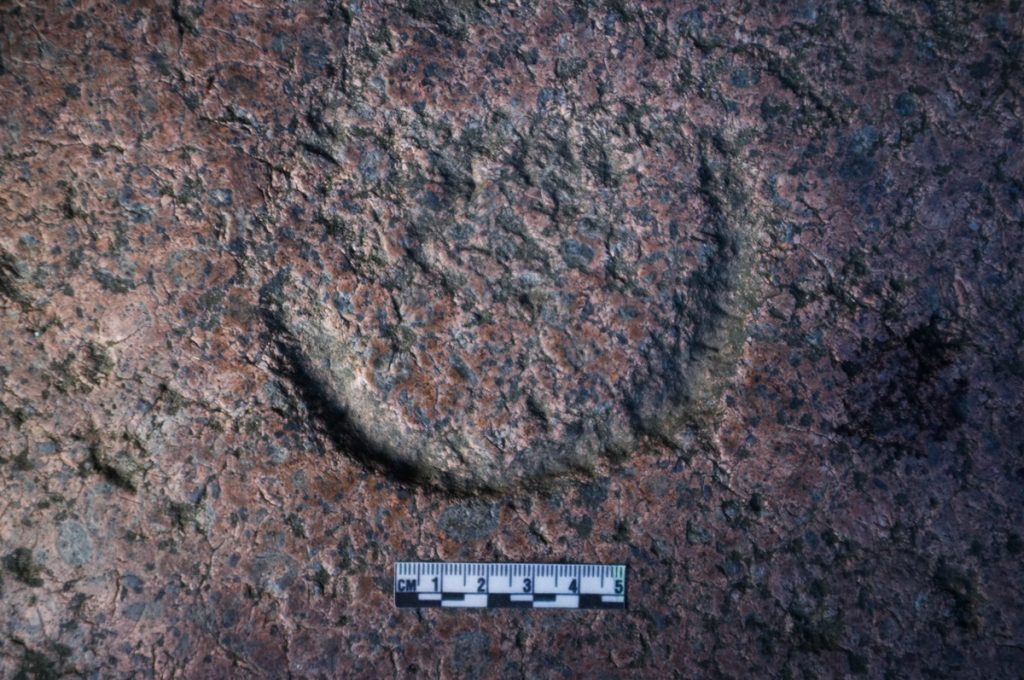
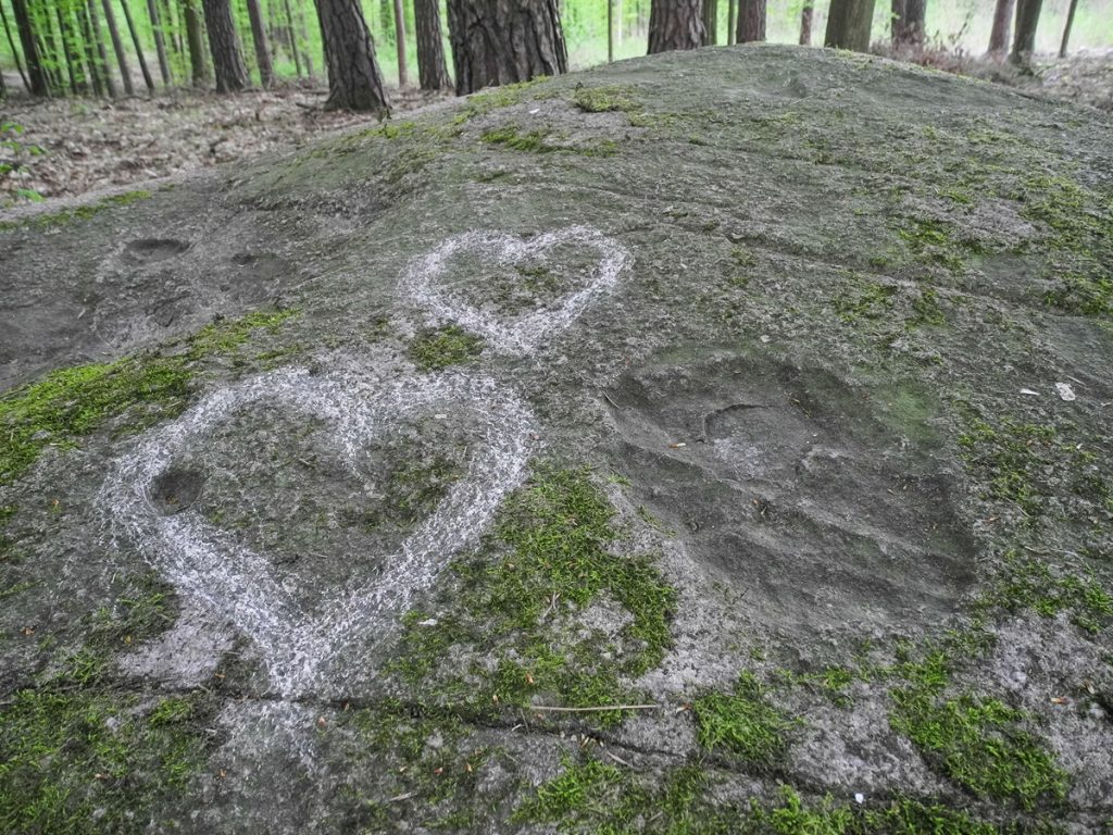
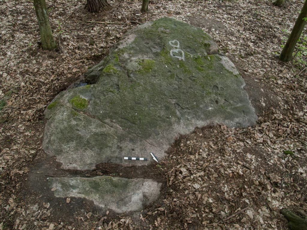
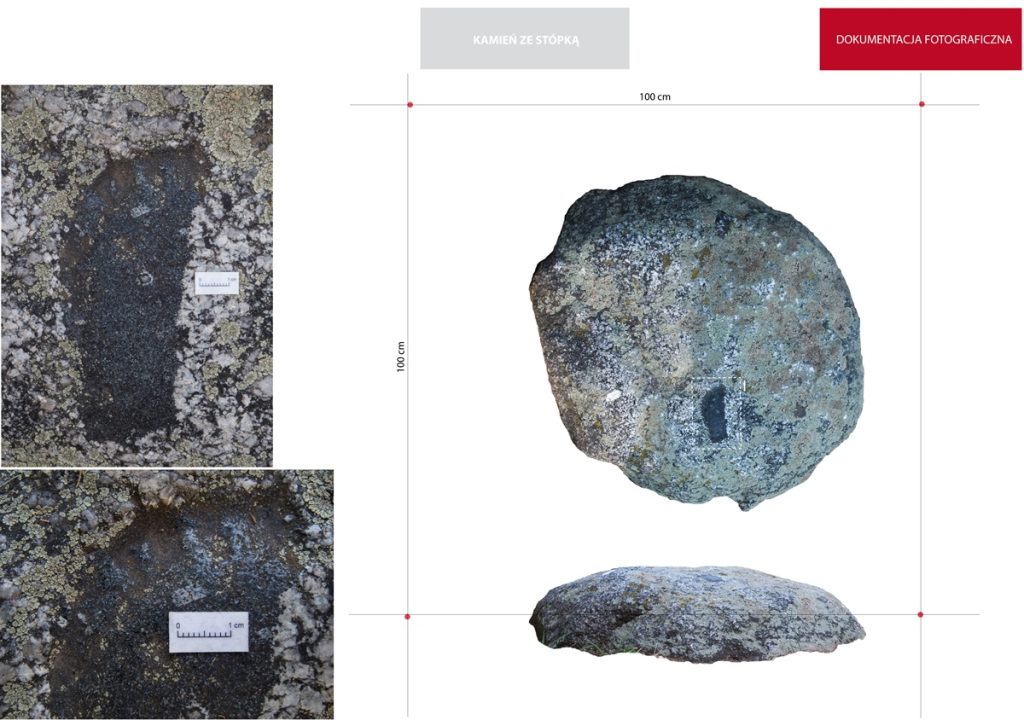
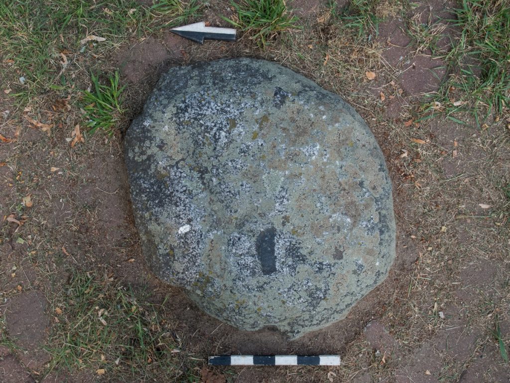
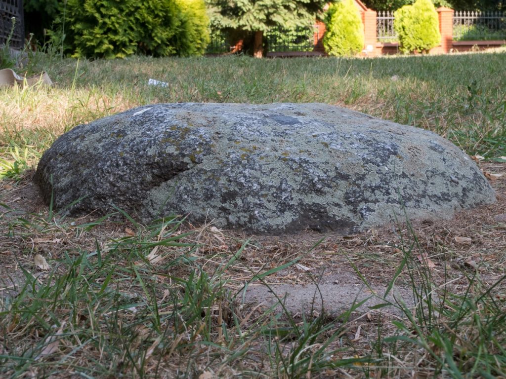
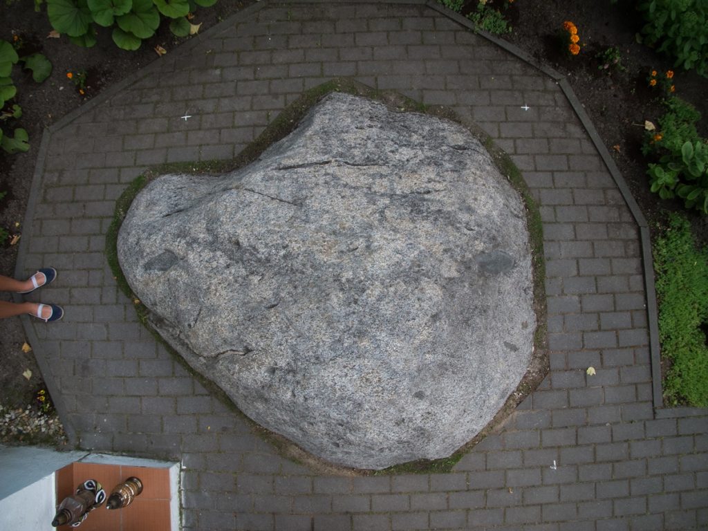
During the first field search in 2009, the visible part of the stone on the surface was documented. In 2013, on the initiative of local people, the boulder was excavated from the ground, while its fragments were placed and displayed next to the shrine. The pit left by the stone was lined with cobblestones. Currently, the shrine as well as the cross standing near it are renovated. The stone with cavities is exposed near the cross.
Sources of information: Werner 1917; Chludzinski 1981; Jot-Drużycki 2002; Herz 2012, 323-324; Miechowicz 2010, 50-52.
Geographic coordinates: 52.05165, 21.57016
Location on Google maps


 A stone "with a bowl", by the "post-Augustinian" church-probably the Church of the O. Pasyonists in Rawa Mazowiecka-was to be located by the wall, on the south side, probably a stone stoup or quern stone.
The stone has disappeared; no information about it could be found during a search conducted in June 2013.
A stone "with a bowl", by the "post-Augustinian" church-probably the Church of the O. Pasyonists in Rawa Mazowiecka-was to be located by the wall, on the south side, probably a stone stoup or quern stone.
The stone has disappeared; no information about it could be found during a search conducted in June 2013.


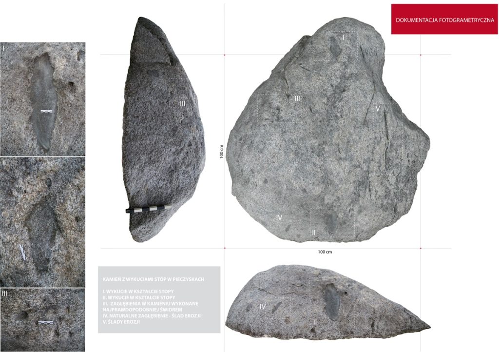


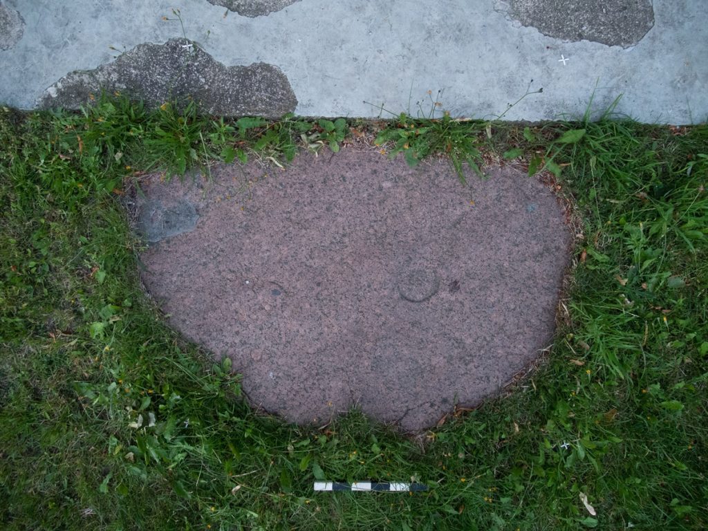
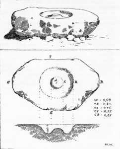
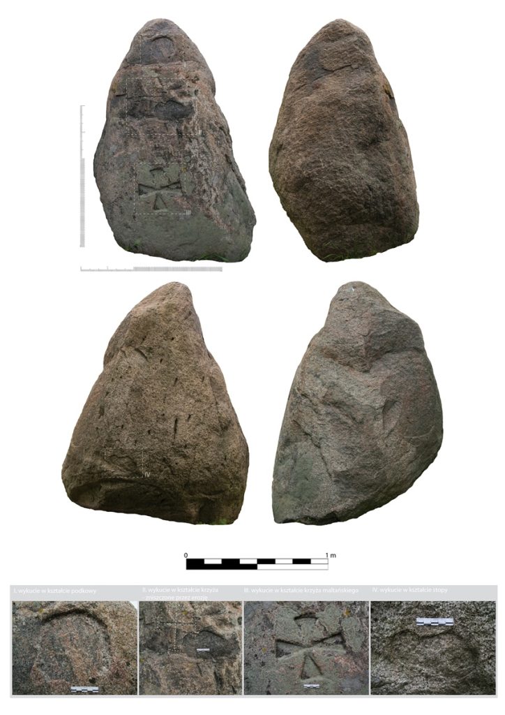
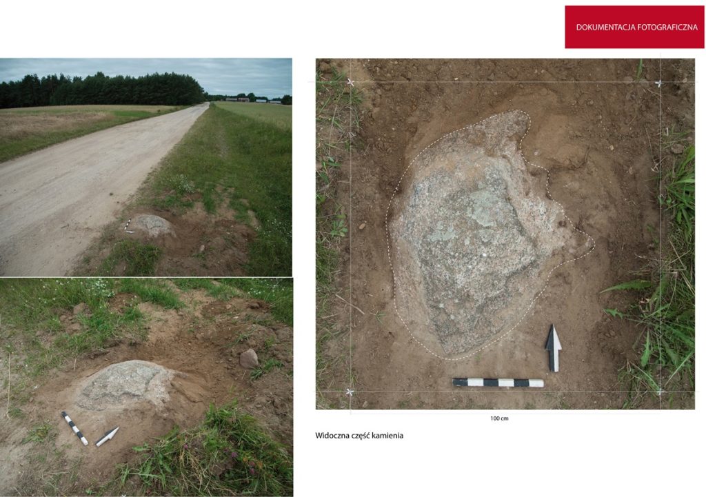
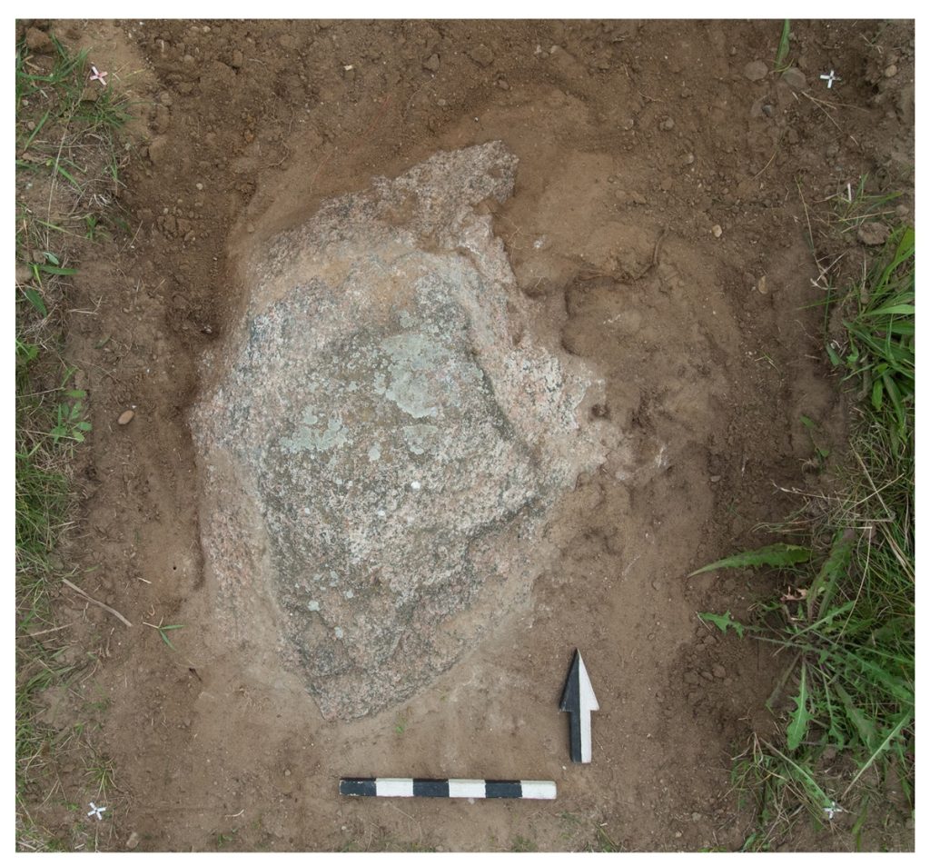
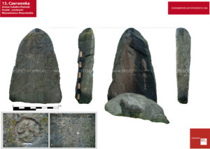 The stone is located at the edge of the village, on the road to Krasow. Its visible part above the surface has the following dimensions: height 170 cm, width at the base 120 cm, at the top 40 cm, thickness from 10 to 20 cm.
On its front part there are engravings: the letter "P", the sign of a wheel with three "spokes", under them the date 1590. Lower the letters S.C.O. and in the lower part a plane with the text and date 1891.
The stone is topped with an iron cross. It is fixed with two smaller stones, stuck in the ground on the front and back sides.
The stone is used as a place of worship; during the annual rite of field consecration, local people gather at the stone and prepare one of the processional altars.
The stone is located at the edge of the village, on the road to Krasow. Its visible part above the surface has the following dimensions: height 170 cm, width at the base 120 cm, at the top 40 cm, thickness from 10 to 20 cm.
On its front part there are engravings: the letter "P", the sign of a wheel with three "spokes", under them the date 1590. Lower the letters S.C.O. and in the lower part a plane with the text and date 1891.
The stone is topped with an iron cross. It is fixed with two smaller stones, stuck in the ground on the front and back sides.
The stone is used as a place of worship; during the annual rite of field consecration, local people gather at the stone and prepare one of the processional altars.


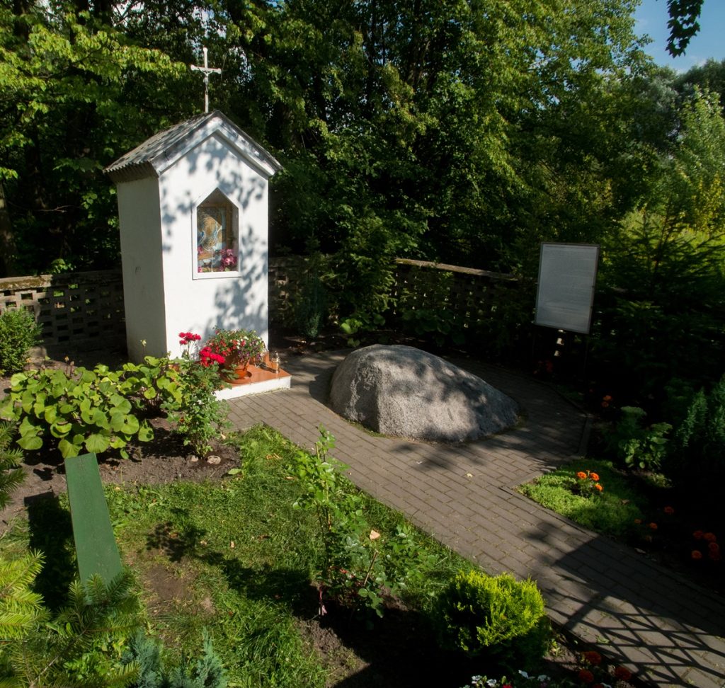
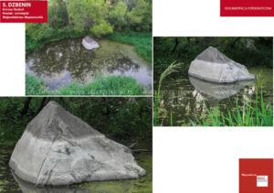 An erratic boulder of gray granite located in the Narew old river bed at the height of the village of Dzbenin.
According to a local legend, the letters "S" once "B" are supposed to be engraved on the stone, which are the initials of King Stefan Batory. During one of his hunts, the king was said to have been wounded by a deer. He was supposed to be bandaged on the stone by a medic. Another legend says that at this spot the king was waiting for his team, which he had lost in the wilderness.
An erratic boulder of gray granite located in the Narew old river bed at the height of the village of Dzbenin.
According to a local legend, the letters "S" once "B" are supposed to be engraved on the stone, which are the initials of King Stefan Batory. During one of his hunts, the king was said to have been wounded by a deer. He was supposed to be bandaged on the stone by a medic. Another legend says that at this spot the king was waiting for his team, which he had lost in the wilderness.


