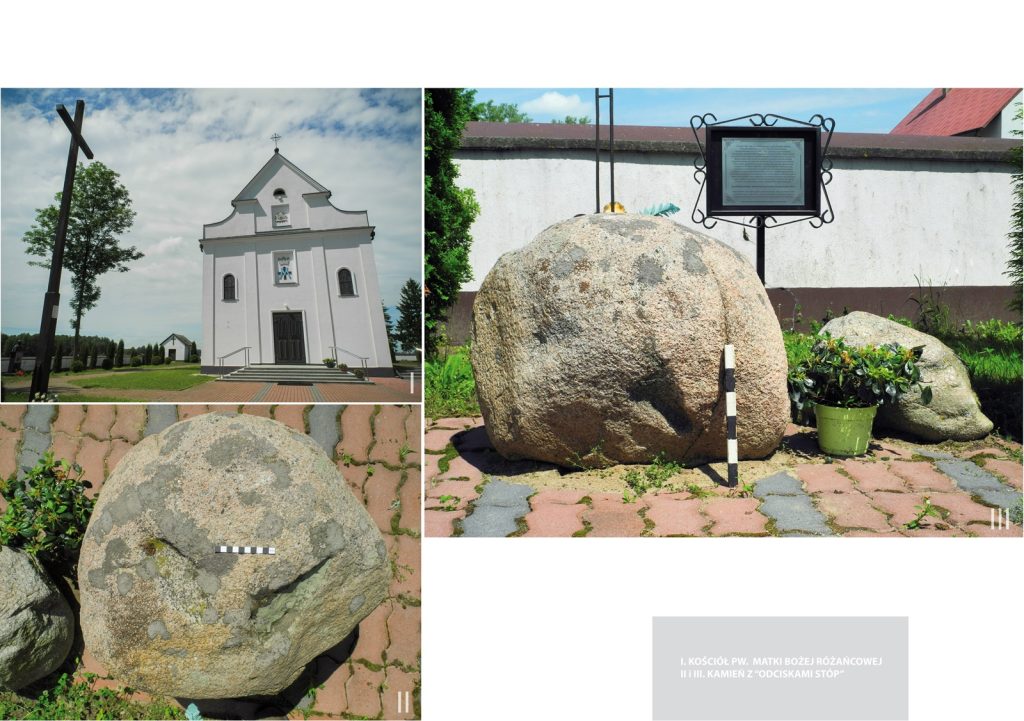
TROUBLE-STANISLAW, GM. SIEMIATYCZE, POV. SIEMIATYCKI
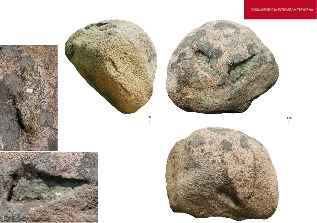
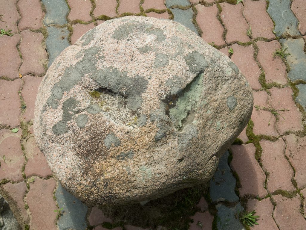
The history of the stone is described on a plaque placed next to the boulder:
"In the years 1880-1900 - at a colony under the forest, between Klopoty Bańki and Klopoty Stanislawami, a village shepherd was grazing the village flocks. At lunchtime, as he was eating his meal, a stranger, a small traveler, appeared by his side. He looked poor and asked the shepherd for something to eat.
The shepherd shared his meager dinner with the guest. The stranger asked the shepherd for directions to the village. He stood on a stone lying there to look in the doomed direction. Thanking him for his hospitality and saying goodbye to the shepherd, he said: "So that you know who you gave food to." Then he disappeared. His footprints remained imprinted on the stone. Surrounding people came to this place, convinced of the miraculousness of the phenomenon. They prayed, and with the water that accumulated during the rain in the hollows of his feet, they washed their sick places and received relief from their ailments. Around 1926 - during land consolidation - the stone was moved to the cross by the highway (today called: "iron cross"). Still local people and a lot of visitors, came to the stone to ask God for relief from their sufferings (especially from skin diseases). A few years ago - the stone was attempted to be stolen twice. Thanks to the vigilance of parishioners, it was saved. [based on a message - Wladyslawa Boguszewska from Kłopot Bujnów, 2007]."
Addendum: "The parish council in 2004 passed a resolution to move the stone, which is an object of worship and a witness to tradition - to the church cemetery, where it will be safe. The relocation of the stone and its location there was accomplished in 2007."
Dimensions of the stone: 80 × 70 × 50 cm.
Sources of information: field search
Geographic coordinates: 52.51171, 22.79432